

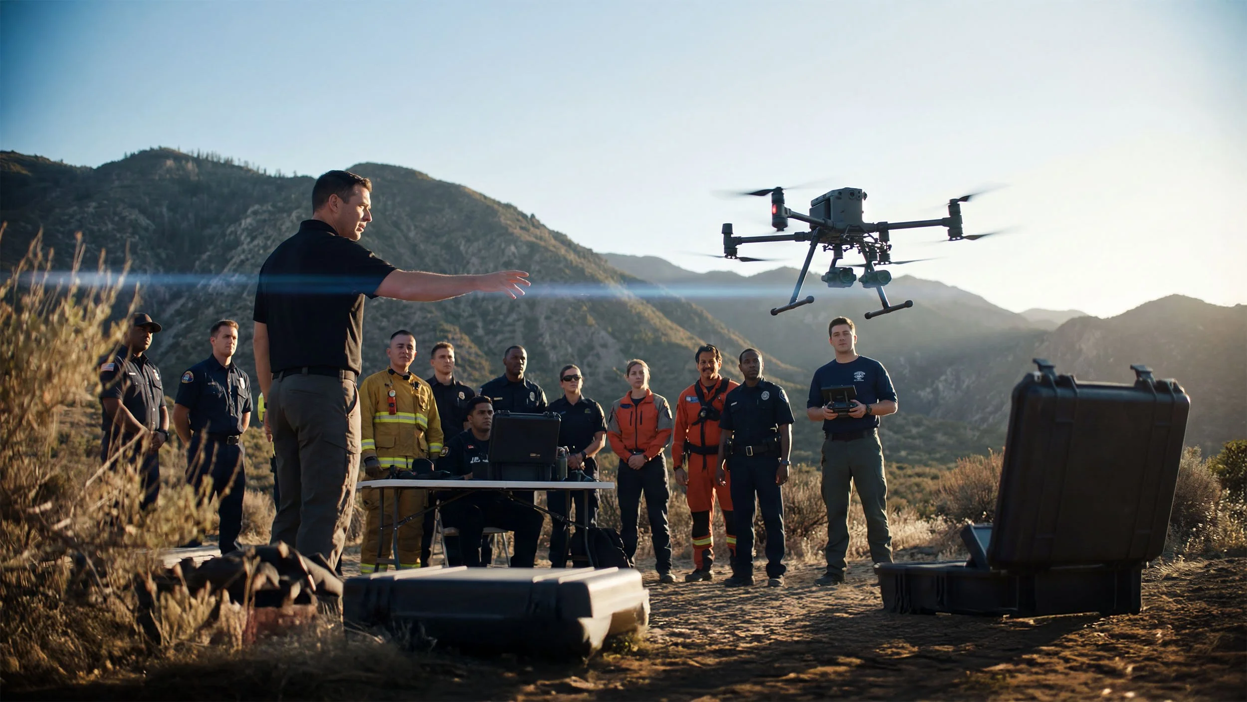
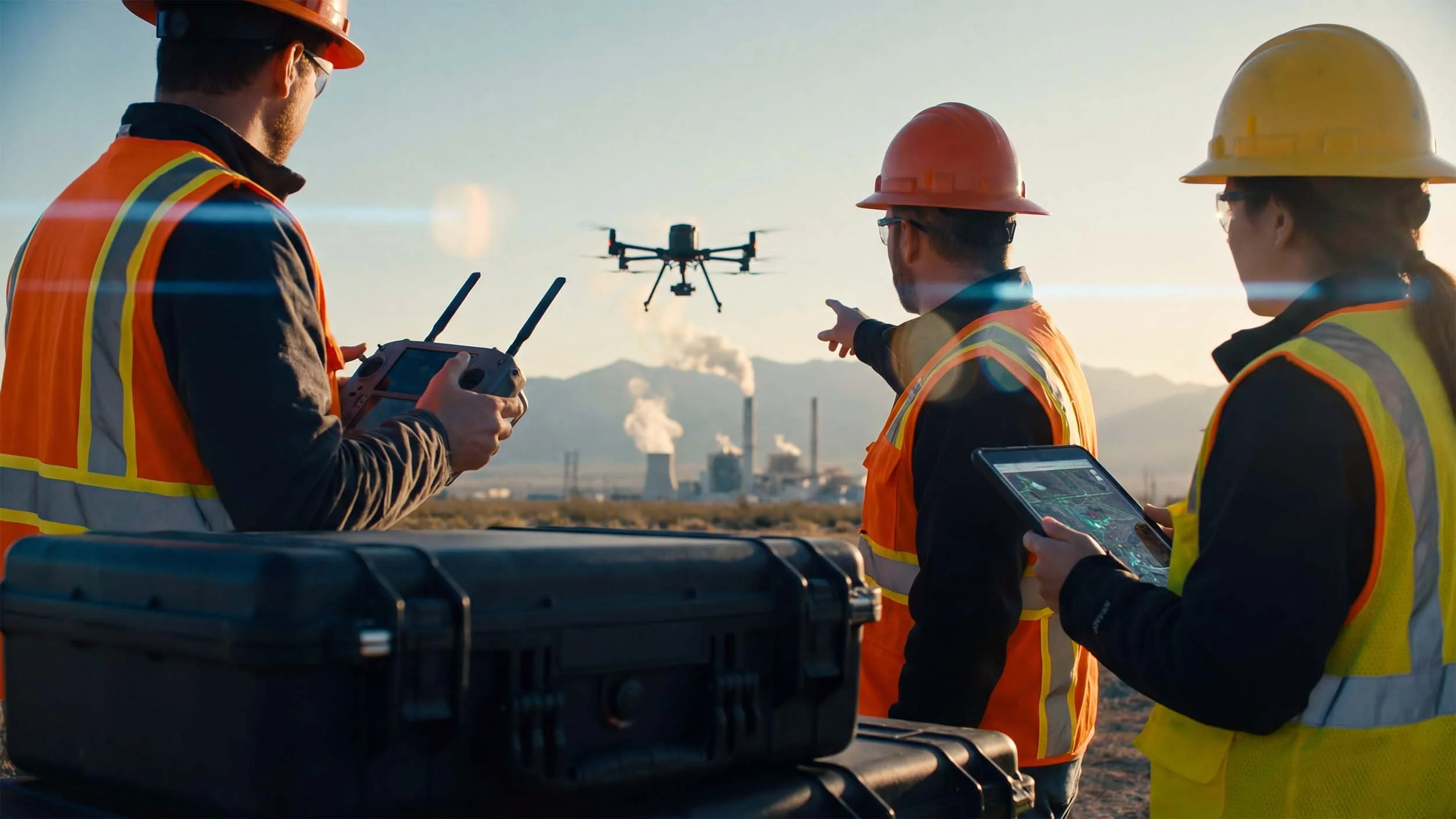
Hands-On Drone Training.
Delivered On-Site.
We transform your pilots into confident, mission-ready operators with customized training that mirrors the challenges you face in the real world. If your team is still building the full program around the training, see our UAS program consulting services.

WE DESIGN OUR TRAINING AROUND:
Your Team
Generic training doesn't account for the unique challenges your team faces. We deliver customized instruction for your pilots' specific skill levels, from new flyers to seasoned operators.
Your Gear
You won't train on a generic drone. Our curriculum is built around the specific aircraft, sensors, and software that you use for your real-world operations.
Your Mission
Our hands-on instruction is tailored to your operating environment. This approach ensures the training is directly applicable and is the fastest way to build genuine operational capability.
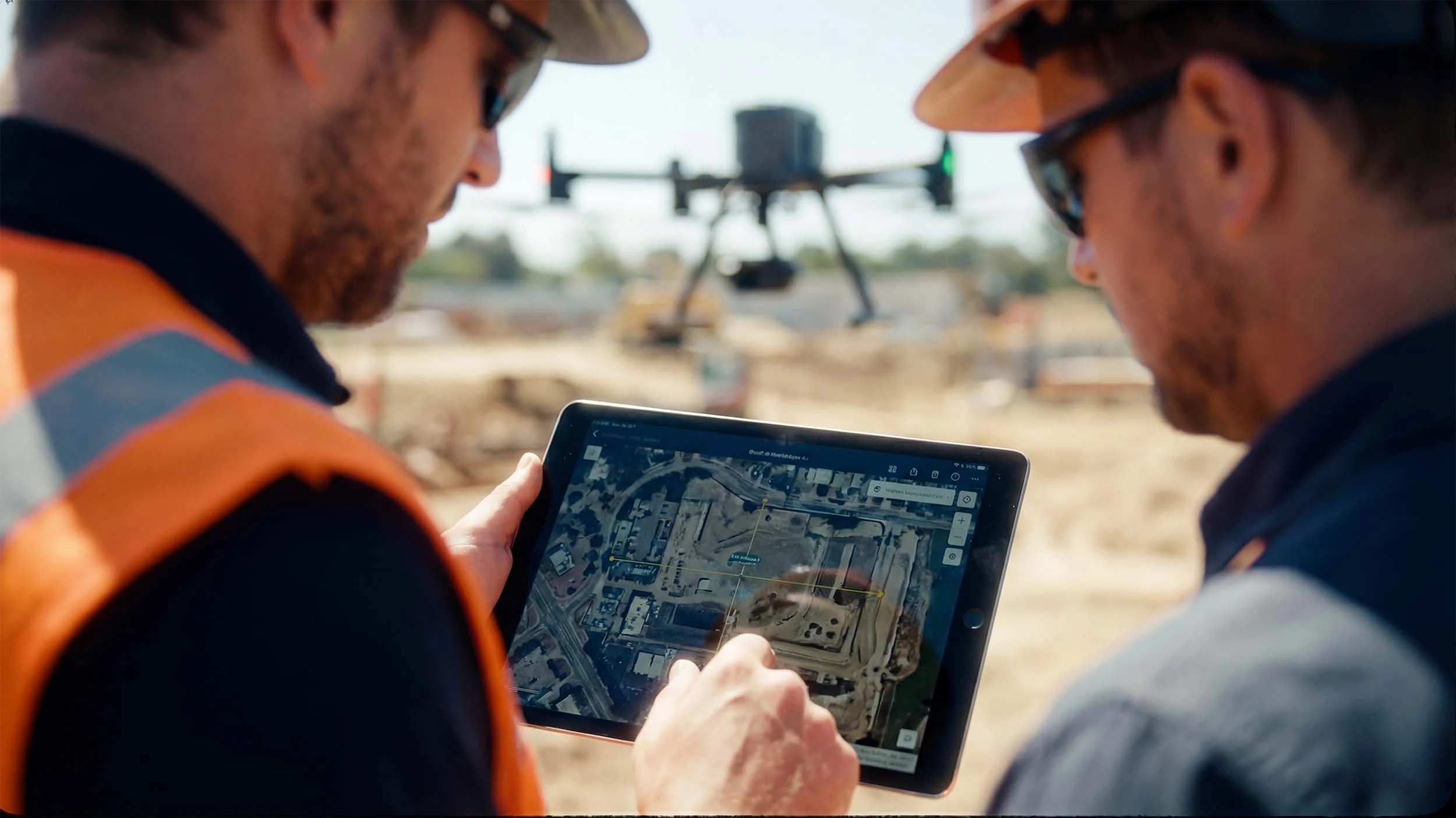
What’s included.
We don't believe in one-size-fits-all training. We work with you to develop a custom curriculum that addresses your specific operational needs, equipment, and environmental challenges.
REAL-World
Scenario TRAINing
Simulate the exact missions your team will fly, from infrastructure inspection to search and rescue operations.
Payload & Sensor Operation
Master the use of thermal cameras, multispectral sensors, LiDAR, and other specialized equipment.
Emergency
Procedures
Train for unexpected events like lost links, GPS failure, and motor issues to ensure safe outcomes.
CREW RESOURCE MANAGEMENT
Develop clear communication and decision-making protocols for your entire drone team.
Advanced Flight Maneuvers
Go beyond basic controls to master precision flying in challenging conditions.
Maintenance & Troubleshooting
Learn to properly care for your equipment to maximize uptime and prevent failures in the field.
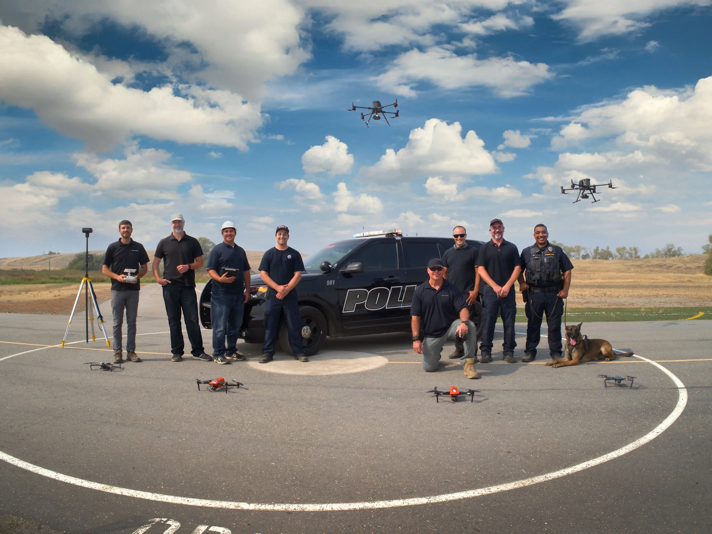
Who We Work With
We've trained pilots and operators across police and fire departments, city governments, utilities, energy providers, infrastructure firms, and construction companies. Our training is built around your people, your equipment, and your environment — because the best instruction is the kind that mirrors the missions your team will actually fly.
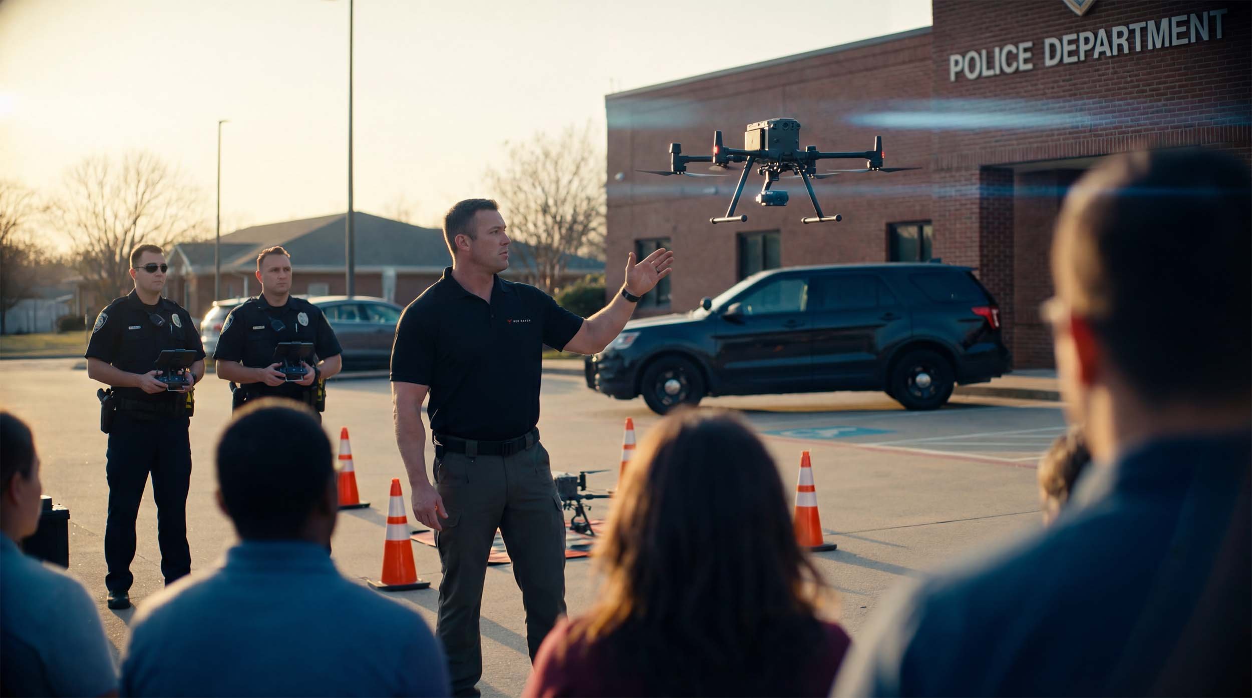
Drone Training for
LAW ENFORCEMENT
Drones have become a vital tool in modern law enforcement, offering rapid aerial visibility, real-time intelligence, and safer ways to assess unfolding situations. From search and rescue to tactical operations, UAS technology enhances decision-making, improves officer safety, and helps agencies respond more effectively across a wide range of missions.
What We Teach:
-
Learn the workflows to integrate drones as initial responders to provide critical situational awareness before units arrive on scene.
-
Deploy thermal imaging and systematic search patterns to cover large areas and locate missing persons faster.
-
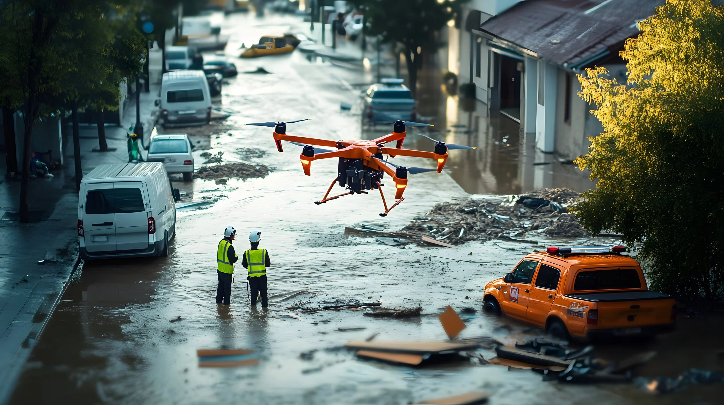
Provide real-time situational awareness for incident command during floods, fires, and other major events.
-
Master the flight patterns and data capture techniques required to create accurate 2D maps and 3D models for investigations and courtroom presentation.
-
Capture high-resolution aerial imagery to document evidence and preserve scene integrity.
-
Learn techniques for providing safe aerial overwatch for officers during active situations.
-
Learn to monitor large crowds and events to identify potential issues and manage resources effectively.
-
Train to support SWAT and other tactical teams with real-time aerial views for entry, clearing, and suspect tracking.
Listen to our podcast episode:
Drone as First Responder: How DFR Transforms Public Safety

Drone Training for
FIREFIGHTING
Drones are transforming how fire departments assess, monitor, and respond to incidents. From real-time aerial views of active firegrounds to locating missing persons in challenging conditions, UAS tools give incident commanders and crews better information—faster—while keeping firefighters out of harm’s way.
What we teach:
-
Provide incident command with real-time thermal views to identify hotspots, track fire progression, and spot potential structural collapse, enhancing firefighter safety.
-
Utilize thermal drones to locate victims in low-visibility conditions, during night operations, or in difficult terrain like collapsed structures or wooded areas.
-
Safely assess hazardous material spills from a distance, identifying leaks, reading container placards, and monitoring plume direction to protect crews from exposure.
-
Learn to monitor a fire's perimeter in real-time, direct ground crews to hotspots, and conduct post-fire analysis to aid in prevention and recovery efforts.
-
Learn to capture high-resolution aerial imagery and create detailed site maps to support fire investigators in determining the cause and origin of a fire, all while preserving the integrity of the scene for official reports.
-
Aerial imagery provides a comprehensive view of fire scenes for after-action reviews, insurance documentation, and investigative reports—capturing details that ground-level photos can easily miss.
-
Learn how to provide a rapid, overhead perspective of fire scenes—allowing commanders to monitor spread, spot secondary hazards, and make informed decisions in real time without relying solely on ground reports.
-
Learn techniques for improving communication between command and crews by offering a shared aerial view of evolving incidents and resource placement.
-
Learn how you can enhance training environments by allowing instructors to observe drills from above, review footage, and simulate real-world aerial workflows—strengthening crew readiness and performance.
Listen to our podcast episode:
Drones in Firefighting: The Ultimate Force Multiplier
Drone Training for
Government & Municipalities
Drones have become essential tools for utility companies and infrastructure operators, offering safer, faster, and more cost-effective ways to inspect assets, respond to emergencies, and protect critical systems. Our training equips teams with the skills to deploy drones confidently in the field—reducing downtime, minimizing risk, and improving operational awareness
What We Teach:
-
Learn to conduct safe inspections and create detailed 3D maps of public infrastructure like bridges, water towers, and municipal buildings to identify maintenance needs and assess structural integrity.
-
Master the techniques to create high-resolution survey maps and 3D models of city areas to support zoning decisions, plan new developments, and manage public land.
-
Train to support Emergency Operations Centers (EOCs) by providing rapid damage assessment after storms, floods, or other natural disasters to help prioritize response and recovery efforts
-
Learn the procedures for providing safe, FAA-compliant aerial overwatch for large public events like parades, festivals, and marathons to enhance public safety and manage crowd flow.
-
Learn techniques for monitoring the health of public parks, tracking waterway erosion, and documenting environmental compliance for municipal projects.
-
Learn to conduct safe and efficient inspections of public assets like bridges, water towers, and municipal buildings to identify maintenance needs, assess structural integrity, and reduce costs.
-
Learn how drones help with perimeter monitoring and site security with real-time aerial views—helping teams detect intrusions, monitor remote areas, and respond faster to threats.
-
Learn how to provide a shared aerial perspective that enhances team communication during inspections, maintenance, and emergency response—improving coordination between field crews, command centers, and decision-makers in real time.
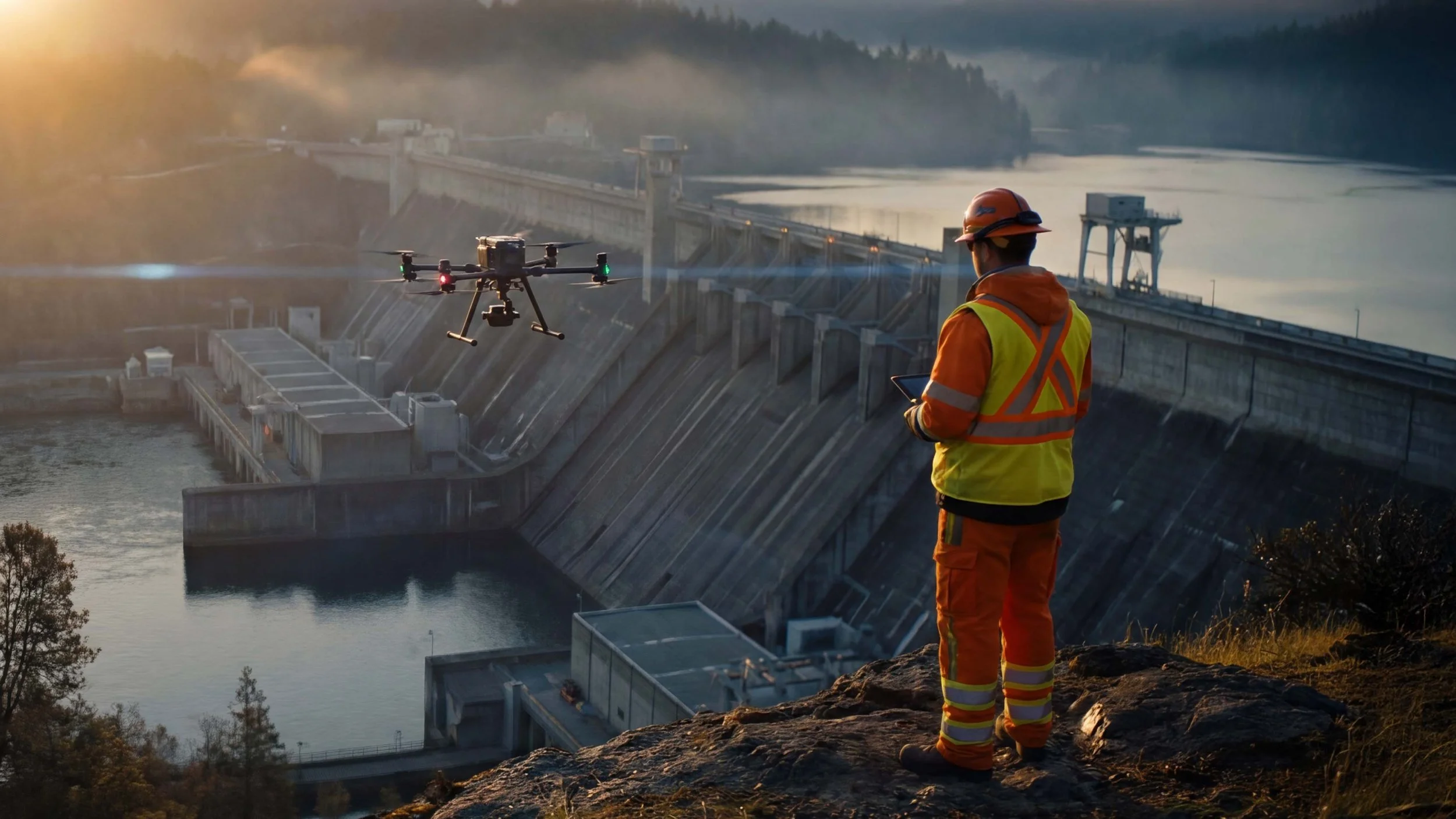
Drone Training for
Utilities & Energy
Drones are transforming how utility and energy companies maintain critical infrastructure. Our training moves beyond basic flight skills to equip your teams with the specialized workflows needed to inspect assets safely and efficiently, assess storm damage rapidly, and ensure grid reliability—all while keeping your crews out of harm's way.
What we teach:
-
Learn to conduct detailed visual and thermal inspections of T&D infrastructure, using high-zoom cameras and thermal imaging to safely identify damaged insulators, conductor issues, and other potential failure points without requiring a line shutdown.
-
Master the techniques for safely navigating complex substation environments to inspect transformers, breakers, regulators, and other critical components, gathering detailed thermal and visual data to proactively identify maintenance needs.
-
Practice using drone data, including LiDAR and photogrammetry, to accurately map Rights-of-Way (ROW) and identify vegetation encroachment that poses a risk to power lines, helping to prevent outages and reduce fire hazards.
-
Train to rapidly deploy drones after severe weather events to assess the extent of damage to the grid, identify downed lines and damaged poles, and provide critical intelligence to direct repair crews more effectively and restore power faster.
-
Develop the skills to efficiently conduct thermal inspections of solar farms, identifying defective cells, malfunctioning panels, and wiring issues to optimize energy production and guide maintenance efforts.
-
Learn the specific flight patterns and high-resolution imaging techniques required for detailed visual and thermal inspections of wind turbine blades, nacelles, and towers, pinpointing damage like cracks or erosion.
-
Master the workflows for capturing high-accuracy survey data to create detailed 2D maps and 3D models of energy infrastructure, supporting planning, asset management, and engineering projects.
-
Learn techniques for efficiently patrolling pipeline Rights-of-Way (ROW) using visual and specialized sensors (like methane detectors) to identify potential leaks, encroachments, or security concerns.
Drone Training for
Construction & Engineering
Drones are reshaping how construction and engineering teams plan, monitor, and manage complex projects. Our training equips crews with the tools and workflows to improve site visibility, reduce risk, and streamline operations—saving time, cutting costs, and enhancing decision-making at every stage of the build.
What We Teach:
-
Learn to capture high-accuracy survey data using photogrammetry and LiDAR to create detailed topographic maps, orthomosaics, and 3D models for site planning, design validation, and earthwork calculations (including roadway/corridor mapping).
-
Master the workflows for conducting regular flights to track construction progress against schedules, generate visual reports for stakeholders, provide defensible documentation for Claims/RFIs/Change Orders, and improve communication.
-
Practice techniques for accurately measuring the volume of stockpiles (soil, gravel, aggregate) and calculating cut/fill quantities, improving inventory management and project cost control.
-
Develop skills to safely inspect hard-to-reach structures like building facades, roofs (including thermal checks for envelope/roofing), bridges, structural steel, MEP installs, and concrete/pavement QA/QC, identifying issues without manual access.
-
Train on capturing drone data compatible with BIM software (Scan-to-BIM workflows) for comparing as-built conditions against design plans, reducing clashes, and ensuring accurate handovers.
-
Learn techniques for using drones to monitor job site safety, identify hazards, document compliance with safety regulations, and track environmental controls (SWPPP monitoring) from an aerial perspective.
-
Monitor erosion, runoff, and environmental impact using aerial data and sensors—helping teams stay compliant and respond proactively to site changes.
-
Real-time aerial views improve coordination between field crews, site supervisors, and project managers—enhancing clarity, collaboration, and overall workflow efficiency.
Drone Training for
Insurance & Commercial Inspection
Drones are revolutionizing how insurance carriers and commercial property inspectors assess risk and document claims. Our training equips adjusters and inspectors with the skills to safely capture detailed aerial data of properties, evaluate damage accurately, and streamline the claims process—improving efficiency and reducing costs.
What we teach:
-
Learn to safely and efficiently capture high-resolution imagery of roof surfaces, identifying damage like missing shingles, hail impacts, or water pooling without needing ladders or manual access.
-
Master the techniques for documenting property damage after events like fires, floods, or storms, creating comprehensive visual records for accurate claims processing and dispute resolution.
-
Train on workflows for rapidly surveying large areas affected by natural disasters, providing carriers with quick situational awareness to understand the scale of damage and prioritize claims response.
-
Develop skills for conducting proactive aerial surveys of commercial properties to identify potential risks (e.g., poor roof condition, overgrown vegetation) for underwriting and risk management purposes.
-
Learn to use thermal cameras to detect moisture intrusion, insulation gaps, and other hidden defects in building envelopes, providing valuable data for both claims and preventative maintenance assessments.
Drone Training for
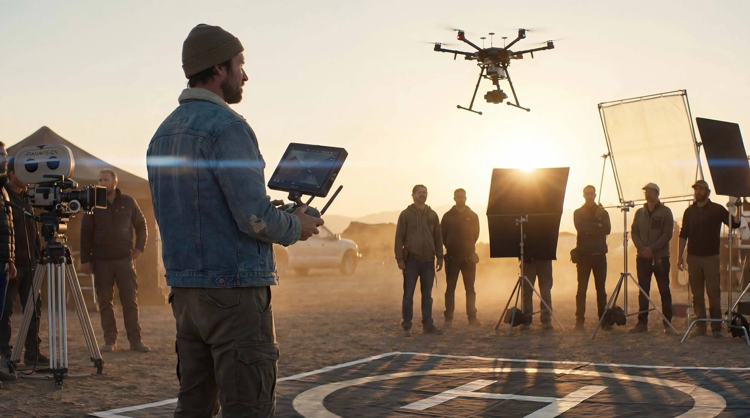
Media & Production
High-quality aerial footage is no longer a luxury—it's a critical component of modern corporate marketing, brand storytelling, and news gathering. Our on-site training equips your in-house creative teams with the skills to safely and consistently capture stunning aerial content that meets brand standards, integrates seamlessly into your production workflow, and elevates your final product.
What we teach:
-
Learn to execute the polished, professional shots required for high-end marketing content, brand anthems, and corporate documentaries, ensuring all aerial footage aligns with your company's visual identity.
-
We train your entire team on a consistent set of advanced camera controls, color profiles (like D-Log), and cinematic techniques to ensure a high, repeatable standard of quality across all your projects and pilots.
-
Develop professional pre-production workflows for storyboarding, pre-visualizing, and safely executing complex drone shots in coordination with directors, producers, and ground crews.
-
Master the technical workflows and safety protocols for integrating live drone video feeds into multi-camera productions for major corporate events, press conferences, and live news gathering.
-
Train on the risk assessment and FAA waiver application process required for legally and safely conducting flights over people, in controlled airspace, or from moving vehicles for high-production value shots.
How it works
Consultation & Needs Analysis

STEP 1
We start with a deep-dive conversation to understand your program's goals, current pilot skill levels, and the specific challenges you face.
Custom Curriculum Development

STEP 2
Our experts design a unique training plan tailored to your team, your equipment, and your mission objectives.
On-Site Training Delivery

STEP 3
We bring the classroom and the flight line to you. Our instructors travel to your location and conduct hands-on training where your team works every day.
Trusted by
Agencies,
Departments
AND Enterprises.
We’ve worked with police and fire departments, city governments, utilities, energy providers, infrastructure firms, and agricultural operations. No two clients are the same—so we meet you where you are and build solutions that last. Need help designing the program before training begins? Start with our drone program consulting.
Drone Training FAQS
Answers to common questions about our drone training programs, delivery, and how to get started.
-
What types of drone training do you offer?
We provide on-site drone training for public safety, government, utilities, and enterprise teams. Our training is built around real-world operations, not just basic flight skills, and is tailored to your specific mission requirements.
What makes your training different?
Most drone training focuses on flying. We focus on operations. That means mission planning, decision-making, safety, compliance, and how drones actually integrate into your workflows—not just how to control the aircraft.
What does a typical training day look like?
A typical training day combines classroom instruction with hands-on flight operations. We cover key concepts in the morning, then apply them immediately in real-world scenarios so your team learns by doing.
How much of the training is hands-on?
A significant portion of the training is hands-on. We prioritize real flight time and scenario-based exercises so your team builds confidence operating in real conditions.
-
Can training be customized for our organization?
Yes. Every training is customized based on your team, equipment, operational goals, and regulatory environment. No two programs are the same.
Can you train our internal team to become trainers?
Yes. We can help develop internal training capabilities, including instructor development and a roadmap for building a sustainable in-house training program.
We already have internal training. Can you improve it?
Absolutely. We regularly evaluate existing programs, identify gaps, and refine training to improve safety, efficiency, and operational effectiveness.
-
Do you train teams with no experience or only experienced operators?
We work with both. Whether you’re starting from scratch or refining an established program, we adjust the training to meet your team at their current level.
Who should be involved in the training?
Training typically includes pilots, supervisors, and decision-makers. Having leadership involved helps ensure the program is implemented effectively after training.
-
Do you provide on-site training?
Yes. We travel to your location and train your team in the environments where they will actually operate.
We don’t have drones yet. Can you provide them?
Yes. We can provide training equipment and also help you evaluate and select the right drones for your program.
How many people can attend the training?
We can accommodate both small teams and larger groups. We adjust instructor ratios and training structure to ensure everyone gets meaningful hands-on experience.
How many instructors do you provide?
The number of instructors depends on the size and complexity of the training. We ensure the instructor-to-student ratio supports safe and effective hands-on learning.
-
Is training a one-time event or ongoing?
It can be either. Many organizations start with an initial training and then schedule follow-up sessions to reinforce skills, onboard new personnel, or expand capabilities.
Can you provide ongoing or recurring training?
Yes. We offer recurring training, advanced modules, and continued support as your program grows.
-
Can we do training to evaluate whether drones are right for us?
Yes. We can structure training as an evaluation phase to help your organization understand how drones can be integrated into your operations before fully committing to a program.
How much does training cost?
Training costs vary depending on the size of your team, location, duration, and scope. We provide custom quotes based on your specific needs.

Let’s Get Your Team Mission-Ready
Whether you're looking to train new pilots, sharpen the skills of seasoned operators, or build a full drone program from the ground up—we’re here to help. Our team combines field-tested instruction with real-world consulting to prepare your people, your process, and your program for success. Need certification first? Start with the FAA Part 107 Course.
Start with a quick consult — no pressure
We’ll review your goals, gear, and team needs
You get a tailored roadmap within 48 hours