Drones in Firefighting: From Fireground Overwatch to Post-Incident Mapping
On a fireground, more video is not automatically better information.
A drone becomes useful when it answers an operational question: Where is the fire moving? What is happening on the roof? Is there a safer access route? Has a searched area been covered? Is a hot spot returning during overhaul? What does the incident commander need to see before committing people or equipment?
That is the role of UAS in the fire service: an observation platform whose value depends on sensor limits, pilot communication, and whether information reaches command in time.
This guide looks at how fire departments can use drones across an incident—from initial size-up through post-incident documentation—while keeping the aircraft integrated with command, aviation safety, and the department’s existing operating structure.
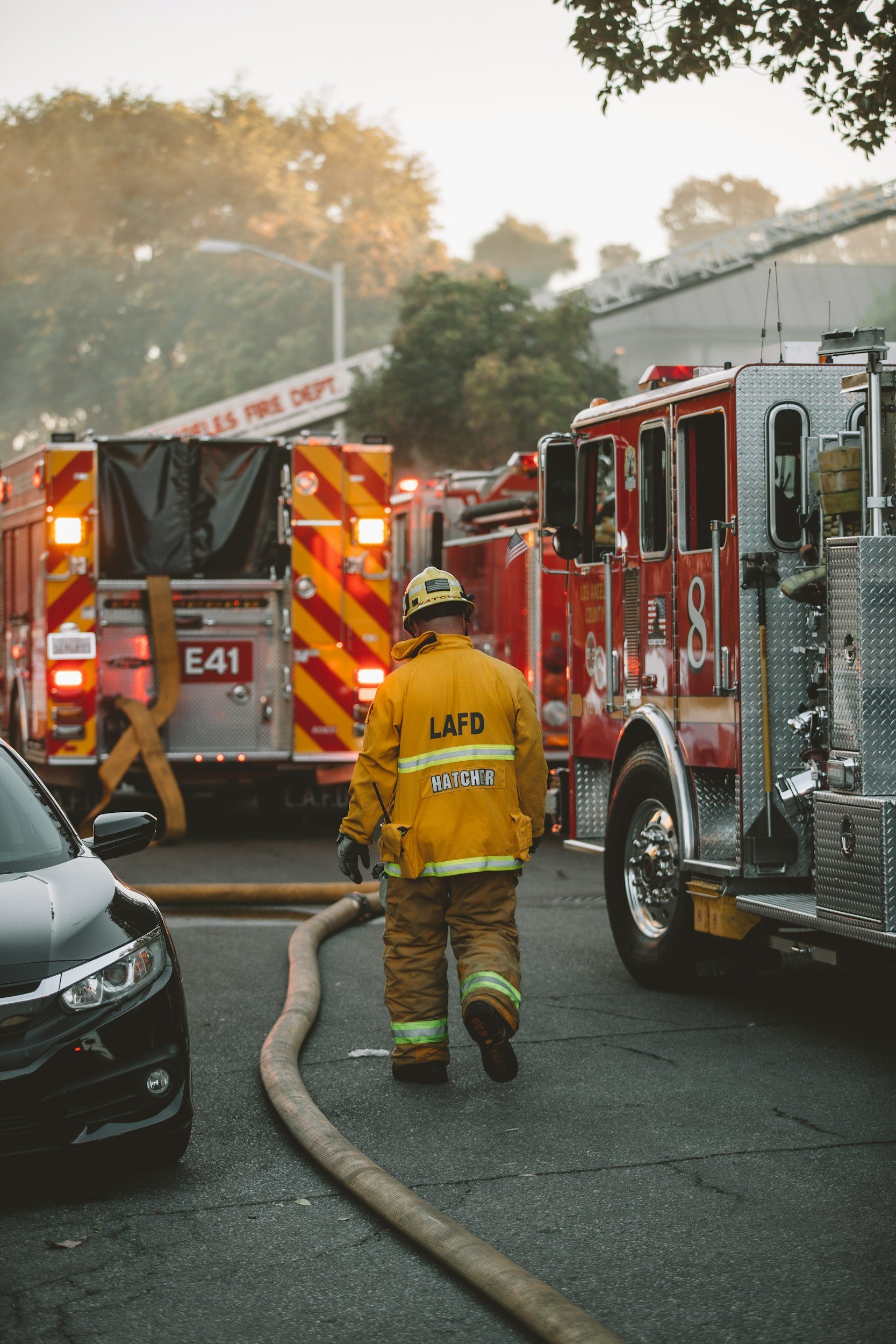
Start with the command question
The fastest way to make a drone irrelevant is to launch without an assignment. A pilot may return with dramatic footage but nothing that changes the incident plan.
Before takeoff, the UAS team should receive a short mission brief:
- What question does command need answered?
- Which area, division, exposure, or search sector has priority?
- Who will monitor the feed and relay findings?
- What terminology and map references are ground crews using?
- What hazard, airspace conflict, weather change, or aircraft warning ends the flight?
The pilot can then frame observations around command objectives rather than narrating everything visible on the screen. “Elevated heat on the Bravo-side roof near the rear parapet” is more useful than “I see a hot area,” but it still needs confirmation and interpretation within the full incident picture.
Structure-fire size-up and overwatch
At a structure fire, a drone can provide a view of the roof, upper floors, exposures, access points, smoke movement, and areas hidden from a ground-level position. Visual and thermal views may help command compare conditions over time and notice changes that warrant a closer look.
The important word is support. A thermal image is not a structural assessment, and a drone should not declare a roof safe. Materials, reflections, moisture, distance, angle, settings, and conditions can affect the image. Report what the sensor shows without overstating what it proves.
A practical assignment might be: monitor the roof over a defined portion of the building, provide updates at agreed intervals, and immediately call out a significant change in the visible or thermal pattern. That produces a repeatable information stream command can combine with interior reports, building construction, fire behavior, and other observations.
Wildland and wildland-urban interface incidents
During a wildland or interface incident, a UAS may help crews observe a perimeter segment, identify areas of residual heat, document spot activity, examine terrain, or assess structures and access routes. It can also support post-fire mapping and damage assessment after the most dynamic aviation activity has ended.
These missions require disciplined airspace coordination. Wildfires may include helicopters, fixed-wing aircraft, temporary restrictions, changing smoke, and multiple agencies. A fire-department drone does not automatically receive priority; it must fit the aviation plan and remain grounded when it cannot be safely integrated.
Begin with a narrow sector and reporting need. Mapping an entire incident without endurance, communications, coordination, and a data plan can consume resources without producing a usable result.
Search and rescue
Drones can help search teams scan open terrain, wooded edges, waterways, rooftops, debris fields, and other difficult areas. Thermal sensors may help an operator notice temperature differences at night, while visual cameras provide context for verifying a possible target and guiding personnel.
Thermal imagery is not automatic detection. Terrain, weather, warm surfaces, animals, sensor resolution, and the subject’s position can complicate a search. Pilots need structured patterns, sector assignments, coverage records, and usable reports.
A good search workflow also separates detection from confirmation. The pilot calls a possible point of interest, records its location, and hands it to the appropriate team. The UAS supports the search plan; it does not replace search management or ground verification.
Hazmat, technical rescue, and inaccessible areas
A drone can provide a remote view of tank cars, placards, containers, damaged structures, slopes, waterways, collapse zones, or other areas where an initial close approach may expose personnel. Depending on the platform and payload, it may also help teams observe plume direction indicators, access routes, or changes around the scene.
The sensor must match the question. Visual or thermal cameras do not replace calibrated atmospheric monitoring or specialized detection. Know what a payload measures, what it only displays, and how findings will be confirmed.
Overhaul, documentation, and after-action review
The usefulness of a drone does not end when the main body of fire is knocked down. A UAS may support exterior hot-spot checks, repeated views of difficult areas, post-incident mapping, damage documentation, and training review.
For investigation or official documentation, the department needs more than attractive footage. Define the capture pattern, preserve original files, record when and by whom the data was collected, control access, and route the material through the correct records or evidence process. Before releasing the scene, confirm that the imagery is complete and usable.
For after-action review, interpret aerial footage with radio traffic, timestamps, ground observations, and the incident plan rather than as a complete record by itself.
Thermal imagery: powerful, limited, and easy to misread
Thermal capability is often the reason a fire department buys a drone. It is also one of the strongest reasons to invest in mission-specific training.
Infrared cameras display thermal patterns. They do not see through walls or determine what is burning or whether a structure will fail. Materials can appear warmer or cooler because of emissivity, reflection, moisture, distance, sensor range, or conditions.
That does not make thermal imagery unreliable. It means the operator needs a disciplined interpretation process:
- Begin with the mission question and a visual reference.
- Confirm the sensor mode, temperature range, focus, and viewing angle.
- Compare patterns over time instead of relying on a single frame.
- Describe what is visible without converting an observation into a conclusion the sensor cannot support.
- Communicate uncertainty and seek confirmation from other information sources.
NIST has emphasized that thermal-imager performance depends on the application and operating conditions. A department should therefore evaluate sensors and train operators against the missions and environments they actually expect—not only a manufacturer demonstration.
Integrate the UAS team with incident command
A drone program should fit the department’s command structure before it arrives at a working incident. The SOP needs to identify who requests the aircraft, who approves the mission, where the pilot reports, how the UAS element coordinates with safety and air operations, and who monitors the feed.
Assigning roles reduces workload. The remote pilot in command remains focused on safe flight. A visual observer monitors the aircraft and surrounding airspace when required by the operation. A payload operator or UAS group supervisor may manage the camera, video distribution, mission queue, and communication with command. Smaller departments may combine roles, but they still need to decide which tasks can be performed safely by one person.
The feed should not become a second command channel. Decide who needs access, how signal problems are handled, and which observations require an immediate radio call.
Build aviation decisions into the fireground plan
Government and public-safety agencies generally operate small drones under Part 107 or qualifying public-aircraft operations under a Certificate of Waiver or Authorization. The right pathway depends on program structure and mission. Controlled airspace, operations beyond visual line of sight, flights over people, temporary flight restrictions, and emergency circumstances can require additional authorization or coordination.
The FAA’s public-safety guidance and Public Safety Toolkit are the starting points. “It is an emergency” is not a blanket permission to ignore airspace rules. The FAA has processes for qualifying emergency operations, but they must be understood and incorporated before a critical incident.
Every deployment should include weather, obstacles, population, airspace, crewed-aircraft activity, battery reserve, communications, launch and recovery areas, and contingency actions. The correct decision may be to delay, relocate, limit, or terminate the flight.
Train for the mission, not only the controls
Part 107 establishes aeronautical knowledge for pilots operating under that rule. It does not teach a firefighter how to interpret thermal imagery on a structure fire, communicate with an incident commander, manage battery rotation during an extended search, or respond when a crewed aircraft enters the area.
Mission-ready training should include:
- Aircraft and payload limitations, emergency procedures, and manual recovery
- Thermal interpretation in realistic materials and environmental conditions
- Structure-fire, wildland, search, hazmat, and documentation scenarios relevant to the department
- Radio discipline and concise reporting within the incident command system
- Airspace deconfliction and immediate response to crewed-aircraft activity
- Night operations, low-visibility conditions, battery management, and safe launch/recovery
- Recurrent evaluation, flight documentation, maintenance, and after-action review
The whole response structure needs some level of training. Pilots must fly and interpret; incident commanders must know what to ask for; company officers and safety personnel must know the aircraft’s capabilities and limitations. Red Raven’s detailed guide to fire-department drone training explains how to close the gap between certification and operational readiness.
A phased way to build the capability
A department does not need to deploy on every mission immediately.
Phase 1: Define and prepare. Choose one or two high-value missions, document the federal operating pathway, write policy and SOPs, select personnel, and match equipment to the mission.
Phase 2: Train and validate. Build platform skills, run realistic scenarios, establish communication with command, test data and video workflows, and qualify pilots against written standards.
Phase 3: Deploy with limits. Begin with approved missions and experienced supervision. Record outcomes, aborted flights, equipment issues, and lessons—not just flight totals.
Phase 4: Expand deliberately. Add missions, pilots, aircraft, automation, or DFR capability only when the existing program is stable enough to support the added complexity.
For the broader policy, budgeting, staffing, and implementation roadmap, see How to Build a Public Safety Drone Program.
Fire-department UAS readiness check
Before operational launch, confirm that:
- The initial mission types and command questions are documented.
- The FAA operating pathway and likely authorization needs are understood.
- Policy defines launch authority, crew roles, safety limits, data handling, maintenance, and reporting.
- Pilots are qualified on the aircraft, payload, and specific missions they may perform.
- Incident commanders and other users understand what the feed can and cannot tell them.
- Airspace and crewed-aircraft coordination are included in drills.
- Thermal findings are communicated as observations and confirmed through the incident process.
- The program has recurring scenarios, evaluations, records, and equipment checks.
- The team can stop a mission without hesitation when risk or coordination becomes unacceptable.
Firefighting drone FAQ
Can a thermal drone see through smoke or walls?
A thermal camera detects infrared energy from surfaces and objects in its field of view. It does not see through walls, and smoke, moisture, distance, viewing angle, material properties, and sensor settings can affect the image. Thermal can be extremely useful, but it must be interpreted by trained personnel and combined with other incident information.
Do fire-department drone pilots need Part 107?
Public-safety agencies generally use Part 107 or qualifying public-aircraft operations under a COA. Requirements differ, so document the selected pathway. Many departments use Part 107 as an aeronautical-knowledge baseline.
What kind of drone should a fire department buy?
Start with the mission. Structure-fire and nighttime search may prioritize thermal and visual sensors, weather resistance, communications, and battery logistics. Wildland mapping may emphasize endurance and processing. Procurement and cybersecurity matter too.
Can a small or volunteer department build a useful program?
Yes. A focused mission set, trained personnel, mutual aid, and repeatable procedures can outperform a larger unstructured fleet. Be realistic about availability, recurrent training, maintenance, and backup coverage.
Give command information it can use
A fire-service drone should not be judged by how impressive the footage looks. Judge it by whether it provides accurate, timely information without creating a new hazard or distracting the incident organization.
Define the mission. Train the crew and command staff together. Treat thermal imagery as a skilled interpretation task. Build airspace coordination into every scenario. Start with a capability the department can sustain, then expand after the workflows have proven themselves.
Red Raven UAS provides mission-specific on-site training and vendor-neutral program consulting for fire departments at every stage—from initial mission analysis through operational exercises and program expansion. You can also listen to Drones in Firefighting: The Ultimate Force Multiplier or contact Red Raven to discuss your department’s needs.
About Red Raven UAS
Red Raven UAS was founded by public safety and drone industry veterans to solve a real problem: agencies and enterprise teams buying drones with no clear plan, no trained pilots, and no compliant program to back them up. We provide vendor-neutral consulting to design and build your drone program, customized on-site training for your team and mission, and FAA Part 107 certification to keep your pilots legal and ready. No hardware sales. No generic courses. Just field-tested expertise built for the real world.
Explore More