

What Can You Do With a Part 107 License? (Every Career Path, Ranked & Explained for 2026)
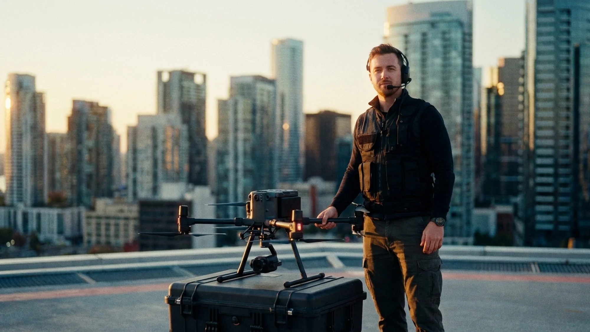
Introduction: The Card in Your Wallet Is Worth More Than You Think
You passed the exam. You printed your temporary certificate, screenshot the confirmation email, and maybe told a few people about it. Now comes the question that nobody in the prep courses actually answers:
What do you do with it?
It's a fair question — and the answer is bigger than most new Remote Pilots realize. The FAA Remote Pilot Certificate (Part 107) is not a participation trophy. It is a federal authorization to conduct commercial drone operations in the National Airspace System. In 2026, that piece of paper unlocks a drone industry that is projected to exceed $58 billion globally — and that number climbs every year as new industries wake up to what UAS technology actually does for their bottom line.
The mistake most new pilots make is thinking Part 107 is a drone photography license. It's not. It's closer to a commercial driver's license. A CDL driver can haul furniture for a neighbor, drive a school bus, operate a concrete mixer, or move hazardous materials across the country. Same license. Completely different careers. Part 107 works the same way.
In this guide, we are going to walk through every major career path open to a Remote Pilot Certificate holder in 2026 — from the well-known ones like real estate photography to the ones most people have never considered, like telecommunications tower inspection and precision agriculture. We'll tell you what the work actually looks like, what it pays, what gear you need, and who's hiring (or buying from you).
Let's get into it.
First: Understanding What "Commercial" Actually Means
Before we talk careers, let's make sure we're aligned on what Part 107 authorizes.
Under Part 107, "commercial" means any operation where you receive compensation — direct or indirect. This is broader than most people think.
Getting paid to film a wedding? Commercial.
Flying a drone to document a construction site for your own company's records? Commercial.
Creating content for a social media account that generates ad revenue? Commercial.
Providing free flights in exchange for a testimonial or referral? Potentially commercial.
The FAA doesn't care if money changes hands at the exact moment of flight. If there is an economic benefit — to you, your employer, or your client — you need the certificate.
This matters because it means the career paths below aren't just for freelancers. They include employees, contractors, government workers, and business owners alike.
Career Path #1: Real Estate & Property Photography
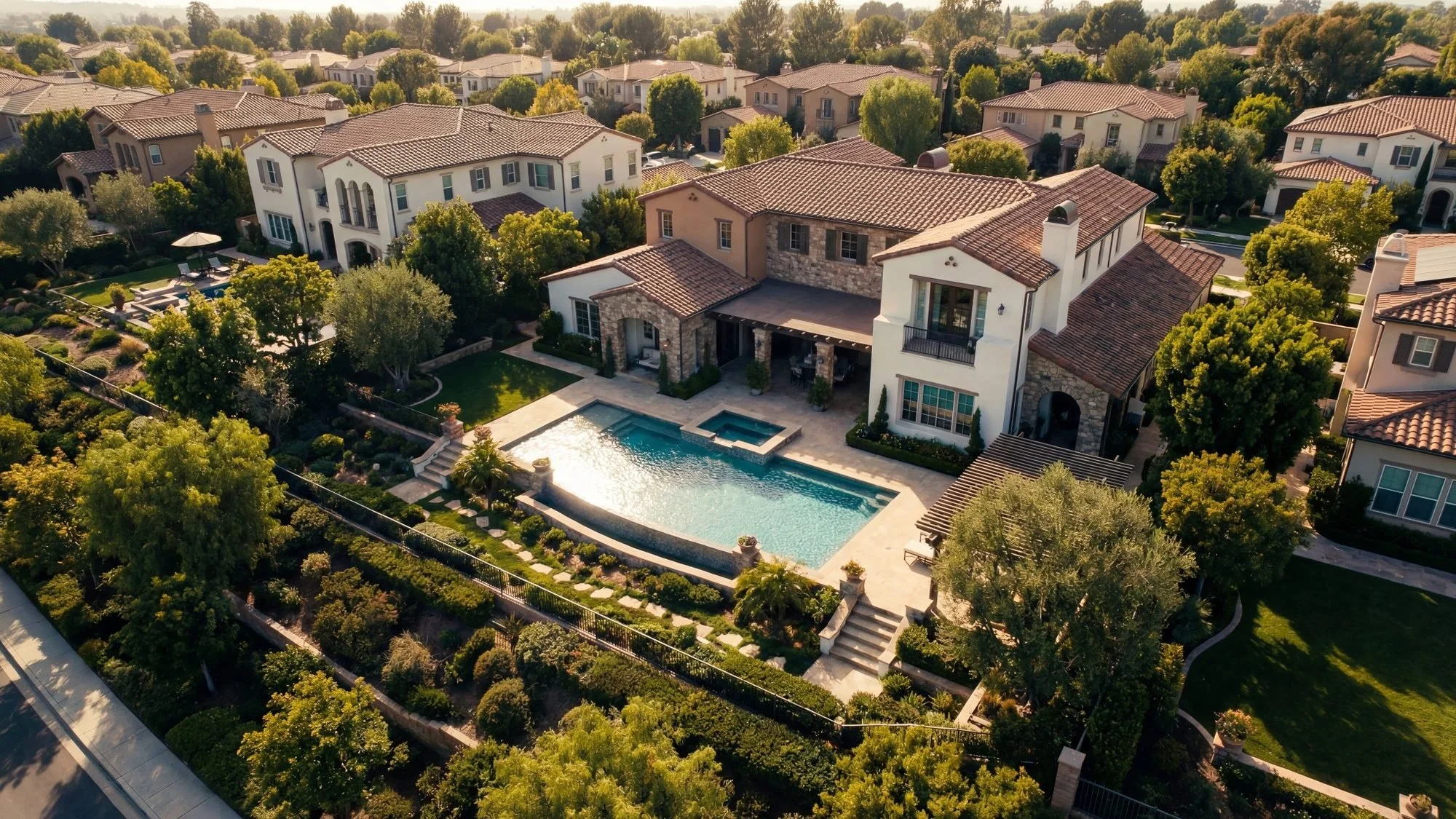
The Work: This is the most common entry point for new commercial pilots — and for good reason. The barrier to entry is relatively low, the market is enormous, and almost every real estate agent in the country is either already using drone footage or knows they should be.
A typical real estate shoot involves 20–40 still photos of the property from various altitudes and angles, plus a short video walkthrough (usually 60–90 seconds) that orbits the home, shows the neighborhood, and captures the lot. You'll also sometimes be asked to do interior video (which doesn't require Part 107 but is a natural upsell).
What It Pays: Entry-level: $75–$150 per shoot Experienced, full-service (stills + video + editing): $200–$500 per shoot Luxury / commercial property: $500–$2,000+
The math is compelling. If you're doing three shoots a day at $250 each, you're grossing $750/day. That's real money for what is often 2–3 hours of fieldwork per property.
What You Need:
DJI Mavic 3 Pro or Air 3 (minimum for professional results)
Basic Lightroom/Premiere Pro editing skills
A reliable turnaround time (agents want photos by the next morning)
E&O (Errors & Omissions) insurance — many real estate agencies require it
The Catch: Real estate is seasonal, weather-dependent, and becoming competitive. In most markets, there are now dozens of Part 107 pilots competing for the same listings. The pilots who survive long-term are the ones who niche down (luxury property, commercial real estate, short-term rentals) or package their services into a full media offering (drone + ground photography + virtual tour + floor plan).
Who's Hiring / Buying: Real estate agents, brokerage firms, property management companies, Matterport service providers, short-term rental platforms like Airbnb (for listing photography).
Career Path #2: Construction & Infrastructure Progress Monitoring

The Work: This is one of the fastest-growing and most lucrative niches in the commercial drone industry — and one of the least talked about. Construction companies are using drones to do what used to take a full survey crew days to complete: document job site progress, identify issues before they become expensive problems, and generate data-rich 3D models that live in project management software.
A typical engagement here isn't a one-time shoot. It's a recurring contract — weekly or bi-weekly flights over the same site for the duration of the project, which could be months or years. You show up, fly a pre-programmed grid pattern, upload the data, and the contractor has a time-lapse of their entire project from groundbreak to ribbon-cutting.
The more advanced side of this work involves photogrammetry — using drone imagery to generate 3D point clouds, topographic maps, and volumetric calculations (measuring how much dirt has been moved, for example). Software platforms like DroneDeploy, Pix4D, and Esri's Site Scan handle the heavy lifting.
What It Pays: Basic progress photography: $300–$600 per flight Photogrammetry / 3D mapping (per acre): $150–$300/acre Monthly recurring contracts: $1,500–$5,000+/month per site
What You Need:
A drone capable of automated grid missions (DJI Phantom 4 RTK, Mavic 3 Enterprise, Autel Evo Max)
Photogrammetry software subscription (DroneDeploy starts around $329/month)
Understanding of coordinate systems (WGS84, UTM) — not required for entry-level work, but critical for surveying-adjacent projects
Professional liability insurance
The Catch: The photogrammetry side of this work has a steeper learning curve. Flying the mission is the easy part; processing the data correctly and delivering it in the format the client needs (DXF, LAS, OBJ) takes time to learn. But once you can do it, you are in a far less crowded market.
Who's Hiring / Buying: General contractors, civil engineering firms, site development companies, project owners (municipalities, developers), construction management software platforms.
Career Path #3: Public Safety — Law Enforcement, Fire & Search and Rescue
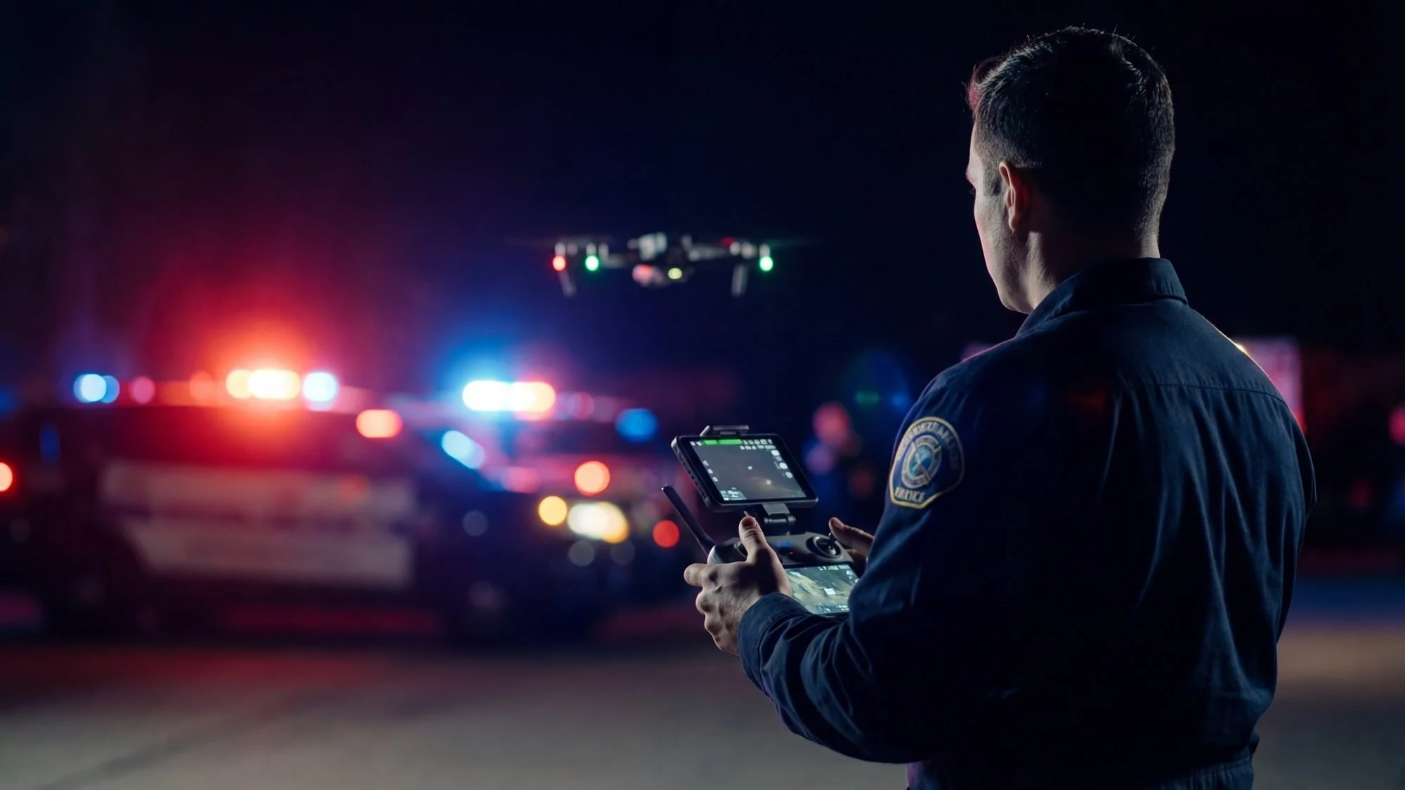
The Work: This is where Red Raven UAS lives — and frankly, it's where the most meaningful drone work happens. Learn more about how we help agencies build compliant public safety drone programs and train their teams for real-world missions. Law enforcement agencies, fire departments, and search and rescue teams across the country are standing up UAS programs at a rapid pace, and they need qualified operators badly.
In public safety, drone operations include:
Perimeter surveillance during active incidents (structure fires, SWAT callouts, active shooter response)
Aerial reconnaissance for incident commanders to size up a scene before committing personnel
Search and rescue — using thermal cameras to locate missing persons in wilderness or urban environments
Traffic accident reconstruction — aerial mapping of collision scenes to produce court-admissible diagrams
Wildfire monitoring — mapping fire perimeters, identifying spotting activity, guiding air resources
This is not a freelance gig. Public safety drone work is almost exclusively done by agency employees or contracted training/program development providers. If you are already a firefighter, law enforcement officer, or paramedic, getting your Part 107 certificate is the first step to becoming your agency's drone pilot — and potentially running the program.
What It Pays: For agency employees, Part 107 is a qualification that supports promotion and assignment to specialized units, not usually a pay grade bump by itself. However, certified UAS operators in public safety agencies often earn 10–25% more in overtime and specialty pay.
For consultants/trainers (like what Red Raven does): $1,500–$5,000+ per training engagement, plus ongoing program development contracts.
What You Need:
Part 107 certificate (mandatory)
Thermal/IR camera experience (FLIR, Zenmuse H20T)
ICS/NIMS familiarity — public safety drone operations fit within the Incident Command System
For search and rescue: specific night operations training, thermal interpretation skills
The Catch: Breaking into this field as an outsider (without an existing public safety background) is difficult. The trust level required to fly during active emergencies is high, and agencies understandably prefer their own personnel. The path in is typically: get the certificate, volunteer with a SAR team, build a track record, then either get hired or consult.
Who's Hiring / Buying: City and county fire departments, law enforcement agencies, sheriff's offices, state emergency management agencies, search and rescue organizations, military contractors.
Career Path #4: Utilities & Energy Infrastructure Inspection
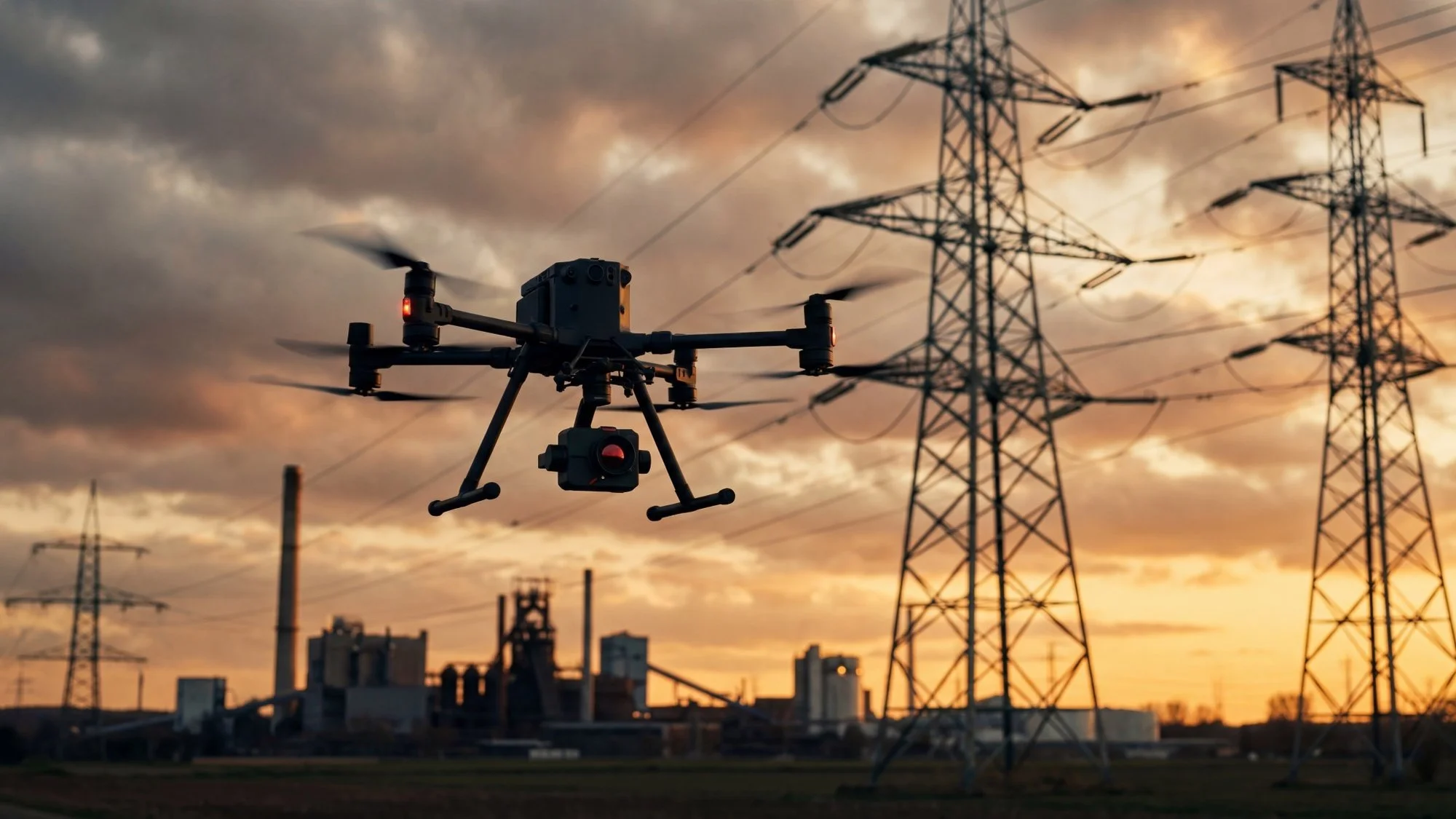
The Work: Power lines, pipelines, wind turbines, solar farms, cell towers, bridges — all of them need regular inspection. All of them used to require either expensive manned helicopter flights or human inspectors dangling from ropes. Drones have fundamentally changed this calculus.
This is arguably the highest-value commercial drone niche on a per-hour basis. A utility company isn't comparing your day rate to a real estate photographer's day rate. They are comparing it to the cost of a helicopter (around $1,500–$3,000/hour) and a two-person rope access team. When you show up with a drone and thermal camera and do the same inspection for $500, you are still delivering enormous value.
The work involves systematic visual inspection of infrastructure — looking for hot spots on electrical equipment, erosion under pipelines, blade damage on turbines, panel degradation on solar arrays. You deliver a structured inspection report with georeferenced images, thermal overlays, and anomaly flags.
What It Pays: Tower/telecom inspection: $350–$800 per structure Power line inspection (linear feet): $0.15–$0.50/foot Wind turbine inspection: $500–$1,500 per turbine Solar farm inspection (thermal): $0.50–$1.50 per panel (large farms = large contracts) Day rate for utility clients: $1,000–$2,500+
What You Need:
Thermal camera capability (DJI Zenmuse H20T or FLIR Vue TZ20)
Zoom lens for standoff distance (inspecting live power lines requires staying well clear)
Inspection reporting software (Scopito, DroneBase/Measure, or custom deliverables)
Comfort with industrial environments and safety culture (PPE, site safety plans, JSA)
The Catch: Getting in front of utility procurement departments takes time. Most contracts in this space go through established vendors or direct outreach to operations managers. Start with small solar installers and local telecom contractors to build a portfolio, then move up to the utility-scale work.
Who's Hiring / Buying: Electric utilities (IOUs, co-ops, municipalities), pipeline operators, wind energy companies, solar farm operators, telecommunications companies, tower owners (American Tower, Crown Castle).
Career Path #5: Film, Television & Commercial Production
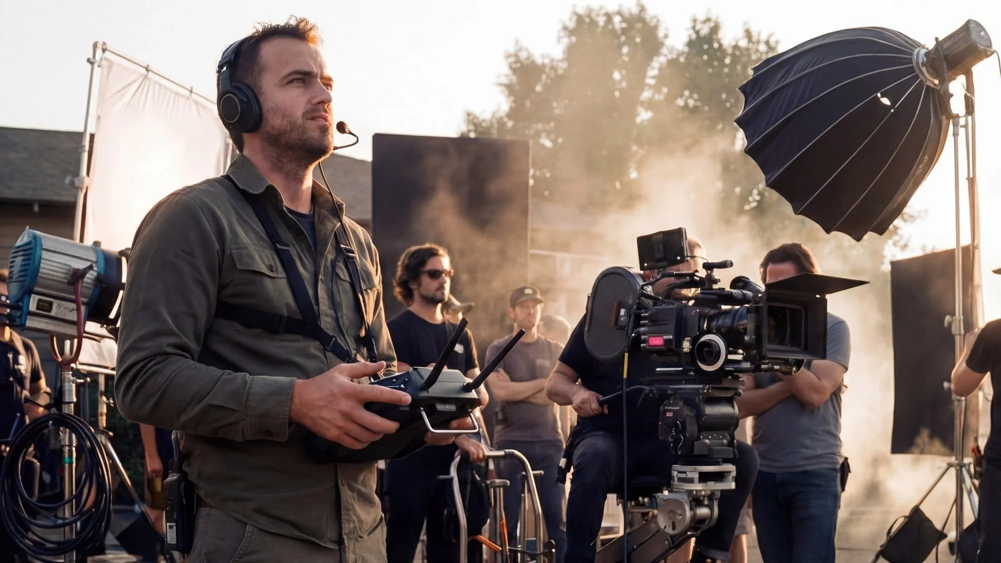
The Work: Hollywood figured out drones before almost anyone else. What used to cost $50,000 in helicopter rental fees for a sweeping aerial shot can now be done for a fraction of that cost with a drone and a skilled operator. Every major film studio, network, and streaming platform uses Part 107-certified aerial cinematographers.
But "film and TV" is the tip of the iceberg. The commercial production world — advertising agencies, corporate video teams, marketing departments — uses aerial footage constantly. Car commercials. Sports broadcasts. Stadium tours. Music videos. Event coverage. Tourism campaigns.
This career path requires more than just flying skill. Aerial cinematography is a craft. You need to understand camera movement, composition, lens selection, color science, and how your drone's flight path creates a specific feeling for the viewer. The pilots who command the highest rates in this space are the ones who can translate a director's creative vision into precise drone movements.
What It Pays: Entry-level commercial production: $500–$1,500/day Mid-level with strong reel: $1,500–$3,500/day High-end commercial/film: $3,500–$7,500+/day Union aerial cinematographers (IATSE): Scale + residuals
What You Need:
High-end cinema drone (DJI Inspire 3, Freefly Alta X with RED/ARRI)
Strong cinematography fundamentals
A compelling demo reel (this is your resume)
Liability insurance — productions require at minimum $2M per occurrence
Network — this industry runs on relationships
The Catch: This is the most competitive niche on this list. Everyone who buys a drone wants to be a cinematographer. Breaking in requires either a breakthrough reel, the right connections, or grinding through lower-budget work until you can get in front of the right decision-makers.
Who's Hiring / Buying: Film studios, production companies, advertising agencies, corporate marketing departments, sports leagues, broadcast networks, music labels.
Career Path #6: Agriculture & Precision Farming
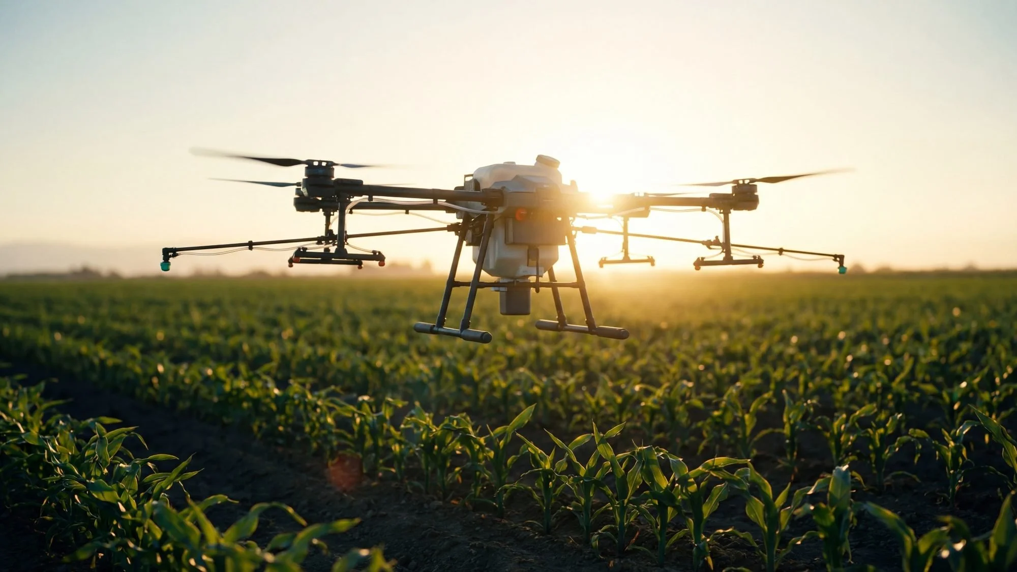
The Work: Agriculture is one of the largest and least-talked-about drone markets in the United States. American farms — particularly in California, the Midwest, and the South — are adopting UAS technology at a rapid pace for two main applications: crop scouting/NDVI mapping and precision spraying.
Crop scouting uses multispectral cameras to produce NDVI (Normalized Difference Vegetation Index) maps — essentially heat maps of crop health that show stressed areas, irrigation failures, pest damage, and yield variance. A farmer who used to walk 500 acres of corn looking for problems can now have a drone map that field in 45 minutes and have a color-coded report showing exactly where to focus.
Precision spraying is the bigger play. Dedicated agricultural drones like the DJI Agras T50 can carry 40+ liters of pesticide or fertilizer and cover 40+ acres per hour — more efficiently and with less chemical waste than ground equipment.
What It Pays: NDVI/multispectral mapping: $5–$15/acre Crop scouting contracts: $500–$2,000/farm/season Precision spraying: $10–$30/acre (varies by crop and chemical) Annual farm contracts: $5,000–$25,000+
What You Need:
Multispectral camera (MicaSense RedEdge, Parrot Sequoia) for mapping work
Agricultural spraying drone (DJI Agras line) for application work — this is a significant equipment investment ($15,000–$30,000)
Pesticide applicator license in most states (for spraying — separate from Part 107)
Agronomic knowledge or a partner who has it (understanding what the NDVI maps mean)
The Catch: The spraying side requires additional licensing beyond Part 107 in most states. The mapping side requires equipment investment and agronomic knowledge to deliver meaningful insights. But the market is vast and largely underserved outside of major ag regions.
Who's Hiring / Buying: Large-scale row crop farms, vineyards and orchards, farm management services, agricultural co-ops, crop insurance providers (aerial documentation of damage claims).
Career Path #7: Mapping, Surveying & GIS
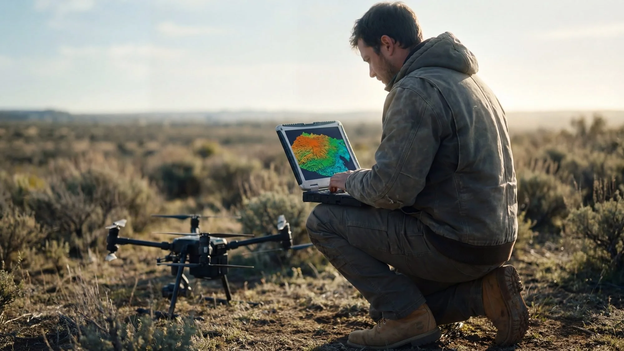
The Work: Mapping and surveying is the most technically demanding career path on this list — and one of the most financially rewarding. Traditional land surveying is a heavily licensed profession, and drone pilots are not surveyors. But drone pilots with photogrammetry skills are being hired by surveying firms, engineering companies, and government agencies to do the data collection that feeds into licensed surveyors' work.
Applications include: topographic mapping for land development, floodplain delineation, mine volume calculations, corridor mapping for roads and pipelines, watershed analysis, and post-disaster damage assessment.
The data products are high-value deliverables: orthomosaic maps (precision aerial images with GPS coordinates), digital elevation models (DEMs), 3D point clouds, and contour maps — all accurate to centimeter-level when using RTK/PPK drone systems.
What It Pays: Entry-level data collection (for surveying firms): $400–$800/day Independent mapping contracts: $500–$2,000+ per project Government/municipal contracts: $3,000–$20,000+ per engagement GIS analyst/drone specialist salary (employed): $55,000–$95,000/year
What You Need:
RTK-capable drone (DJI Mavic 3 Enterprise RTK, Phantom 4 RTK)
Photogrammetry software proficiency (Pix4D, DroneDeploy, Agisoft Metashape)
GIS fundamentals (ArcGIS, QGIS) — at minimum enough to deliver clean final products
Ground control point (GCP) workflow knowledge for non-RTK operations
The Catch: The distinction between surveying and drone mapping matters legally. In many states, "surveying" is a licensed profession and making legal property boundary determinations requires a Licensed Professional Surveyor (PLS). Drone pilots operating in this space need to understand where the line is — and most operate as data collection subcontractors to licensed survey firms, which is entirely legal and extremely lucrative.
Who's Hiring / Buying: Land surveying firms, civil engineering firms, municipal governments, mining companies, environmental consultants, FEMA and state emergency management agencies, oil and gas companies.
Career Path #8: Insurance & Claims Documentation
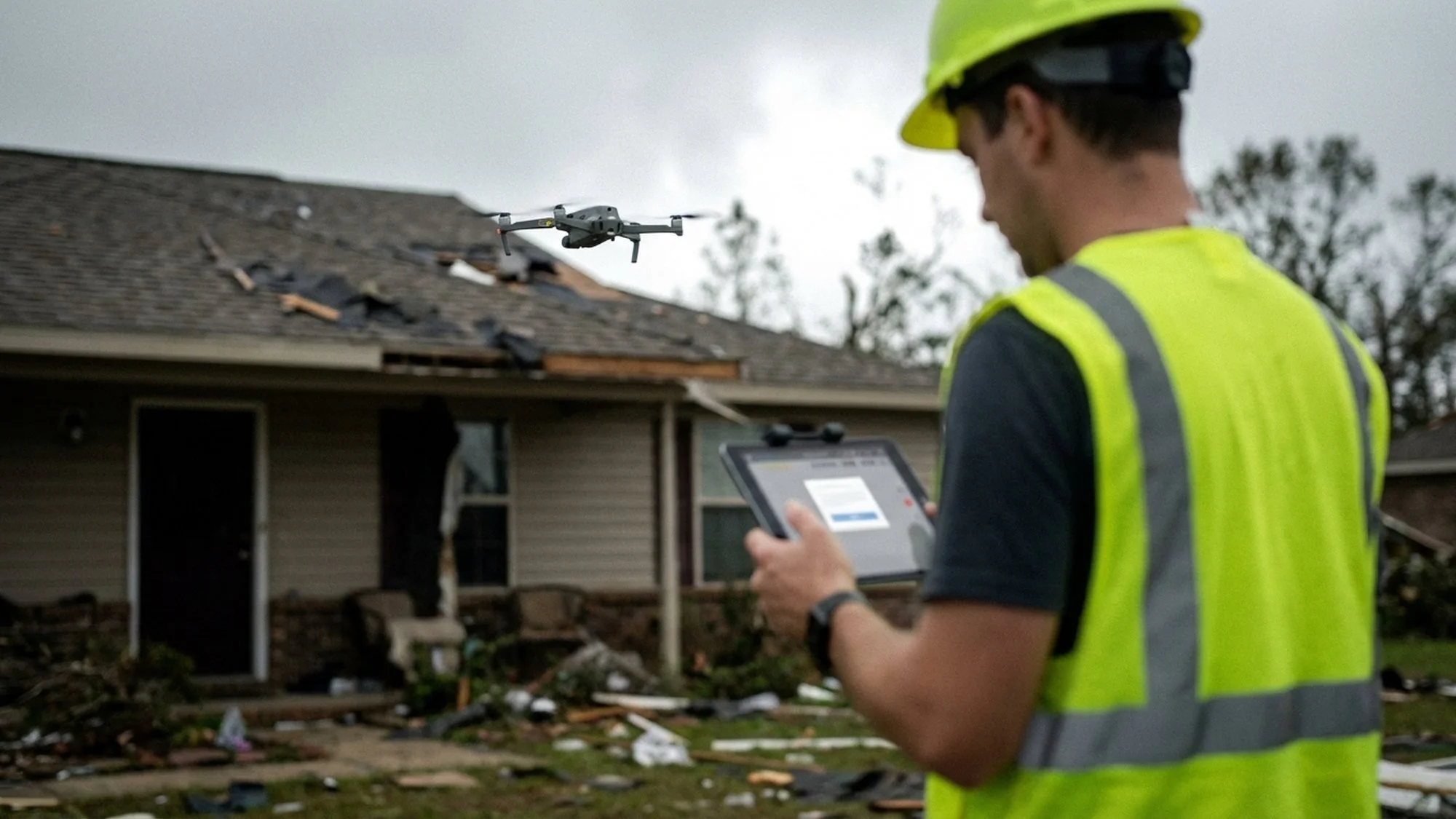
The Work: Every time a major storm, wildfire, or flooding event hits the United States, insurance companies need to assess damage — fast and at scale. Thousands of properties. Roofs that are too dangerous for adjusters to walk. Sites that are still inaccessible by ground. Drones solve this problem.
Insurance drone work involves systematically photographing and documenting property damage — roofs, structures, vehicles, agricultural damage — and generating organized, georeferenced photo reports that adjusters can use to process claims without ever setting foot on the property.
This is also a growing market for routine underwriting inspections — insurance carriers wanting aerial documentation of a property before issuing a new policy, rather than after a claim.
What It Pays: Per-inspection (residential): $75–$200 Per-inspection (commercial): $200–$600 CAT (catastrophe) response deployment: $400–$1,200/day + travel/lodging Annual inspection contracts with carriers: Varies widely
What You Need:
Reliable, redundant equipment (catastrophe deployments are not the time for gear failures)
Efficient, systematic documentation workflow
Familiarity with insurance reporting standards
A way to scale up quickly during CAT events — relationships with other Part 107 pilots to form a network
The Catch: The day-to-day inspection market has attracted large-scale platforms (Betterview, Loveland Innovations, Cape Analytics) that use drone imagery and AI to automate the process. Individual pilots compete by being local, fast, and full-service. The CAT deployment market is less automated and still heavily dependent on deployable human pilots.
Who's Hiring / Buying: Property and casualty insurance carriers, third-party inspection companies, independent adjusting firms, restoration contractors (for pre/post documentation).
Career Path #9: Environmental Monitoring & Conservation
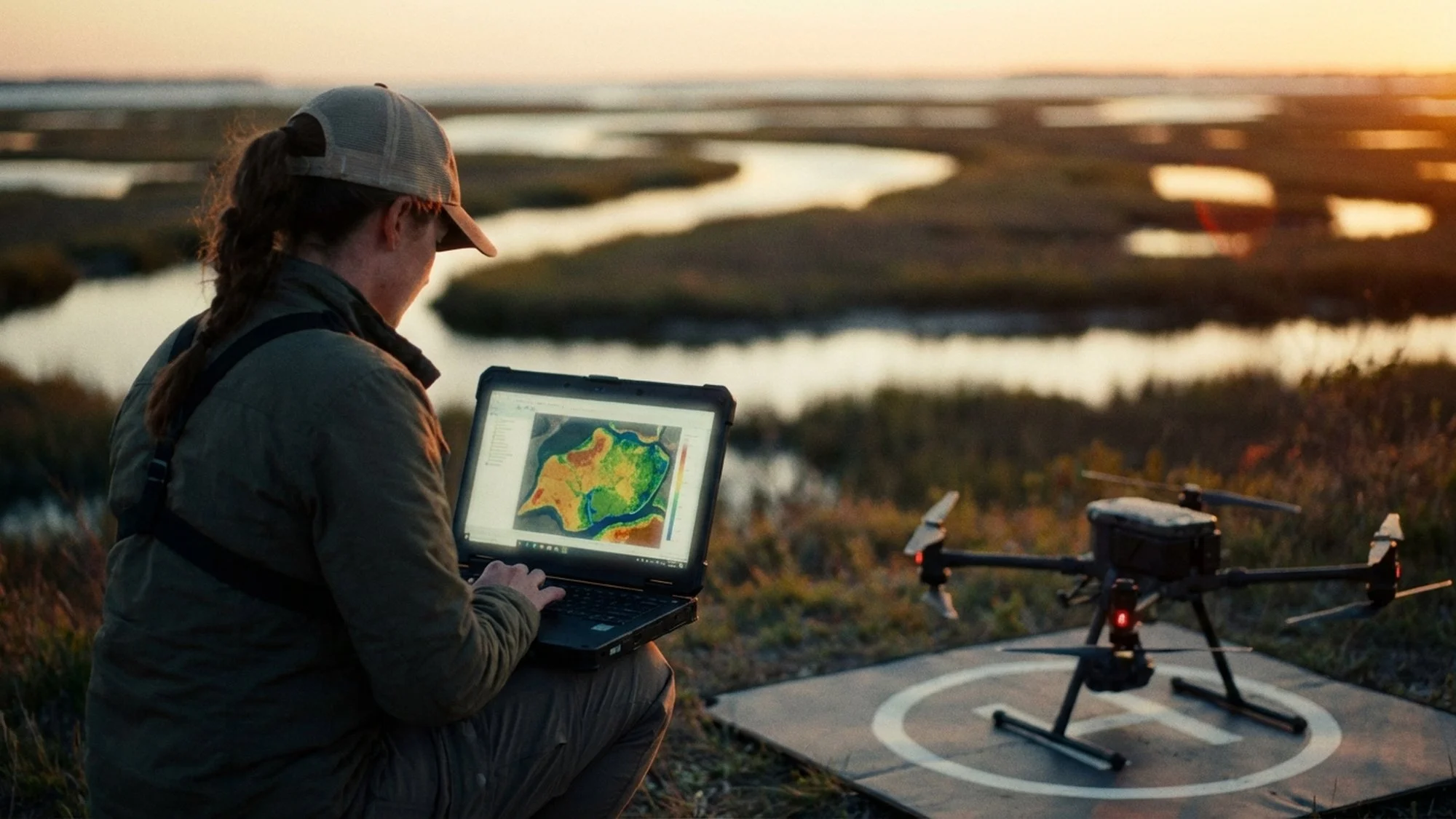
The Work: Scientists, conservationists, and government agencies are using drones to do things that were previously impractical or impossible: counting wildlife populations, mapping wetlands, tracking invasive species, monitoring shoreline erosion, and documenting illegal activity in protected areas.
This career path is less financially lucrative than utilities or surveying, but it's among the most meaningful work a drone pilot can do. If you have a background in biology, ecology, environmental science, or resource management, combining that expertise with a Part 107 certificate makes you exceptionally valuable in this space.
Applications include: aerial wildlife surveys (counting elk herds, nesting colonies, marine mammals), habitat mapping using multispectral or LiDAR sensors, post-fire vegetation recovery monitoring, and coastal erosion documentation.
What It Pays: Contract data collection for research institutions: $300–$700/day Grant-funded field positions: $45,000–$75,000/year Government agency positions (USGS, NOAA, Forest Service): $50,000–$85,000/year
What You Need:
Part 107 certificate
Domain expertise in the relevant field (biology, ecology, GIS)
Multispectral or thermal sensor experience
Familiarity with scientific data collection protocols
The Catch: Much of this work is grant-funded, which means it is cyclical and sometimes uncertain. Permanent positions with government agencies are competitive. The best path is often to volunteer with research institutions to build a portfolio, then compete for funded positions.
Who's Hiring / Buying: Universities and research institutions, USGS, NOAA, US Fish & Wildlife, state wildlife agencies, environmental NGOs, conservation land trusts.
Career Path #10: Training, Consulting & Program Development
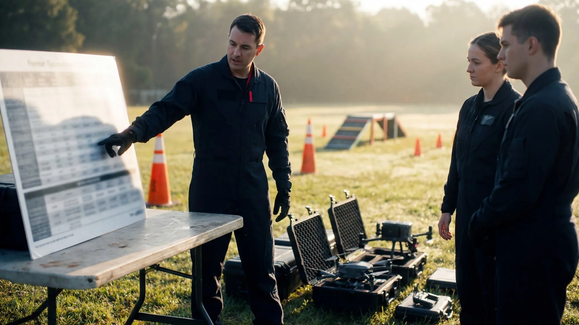
The Work: This is the career path that most pilots never think about — until they realize they are one of the most experienced drone operators in their organization, city, or industry, and people keep calling them for help.
As drone adoption accelerates across every sector, the demand for qualified instructors, program developers, and compliance consultants is enormous. See how Red Raven approaches UAS program development and consulting. Organizations that need to stand up a UAS program — a city government, a utility company, a law enforcement agency — don't want to figure it out themselves. They want to hire someone who has already done it.
This career path is built on experience. You need to have done the work — flown real missions, built real programs, made real mistakes — before you can credibly teach or consult. But once you have that foundation, it is one of the highest-leverage ways to apply your Part 107 certification.
What It Pays: Per-day training rate: $1,500–$5,000+ Program development consulting: $5,000–$25,000+ per engagement Retainer consulting (ongoing): $2,000–$8,000/month
What You Need:
Significant real-world flight experience across multiple mission types
Domain expertise in a specific vertical (public safety, utilities, agriculture, etc.)
Teaching and communication skills
A network of past clients who can vouch for your work
Who's Hiring / Buying: Any organization standing up a new drone program. This includes city governments, fire departments, utilities, universities, enterprise companies, and private businesses.
How to Choose Your Path (A Decision Framework)
With ten career paths on the table, the question becomes: where do you start?
Here's the honest answer: your best career path is the intersection of your existing background, your available equipment, and your local market.
If you're a firefighter or law enforcement officer, public safety UAS is your obvious lane — your credibility in the operational environment is irreplaceable and hard to fake. If you work in construction or civil engineering, your understanding of the industry workflow makes you an immediately valuable drone operator for your own firm or as a freelancer. If you have a creative background, aerial cinematography and real estate media are natural entry points.
The pilots who struggle are the ones who buy a drone, get their certificate, and then try to build a drone business with no existing industry anchor. They end up competing on price in the most crowded niches (real estate photography) with people who have been doing it for years.
The pilots who thrive treat Part 107 as a tool — a federally recognized capability that amplifies expertise they already have.
The Numbers Are Real: What the Drone Industry Looks Like in 2026
Let's put some context around all of this.
The commercial UAS market in the United States is on a clear growth trajectory. The FAA has issued over 300,000 Part 107 certificates. There are now over 800,000 registered drones in the U.S. The BEYOND and UAS Integration Pilot Program work has paved the way for expanded BVLOS (Beyond Visual Line of Sight) operations, which will open entirely new delivery and infrastructure inspection markets over the next five years.
What this means for a new Remote Pilot in 2026: you are entering the market at a moment when commercial drone adoption is still early enough that skilled, credible operators can build real careers — but mature enough that clients have budgets, standardized workflows exist, and the industry is taken seriously.
The ceiling in this industry is genuinely high. The pilots and companies that invested early in real estate and mapping are now running seven-figure businesses. The ones entering now in emerging niches like precision agriculture, BVLOS inspection, and AI-assisted mapping will likely say the same thing in five years.
The First Step Is the Same Regardless of Which Path You Choose
Every single career path on this list starts with the same thing: the Part 107 certificate.
It's the baseline credential. Without it, you can't legally fly commercially. With it, you can access every market described above, build real client relationships, and operate with the confidence that comes from knowing you understand the airspace, the rules, and your responsibilities as a Remote Pilot in Command.
Getting certified isn't just a legal requirement. It's a signal — to clients, to employers, and to yourself — that you take this seriously.
If you're ready to join the ranks of credentialed commercial drone pilots, Red Raven UAS built our Part 107 Prep Course specifically to get you there — without the noise, the outdated content, or the generic test-prep experience.
Our course is:
Fully updated for 2026 — Remote ID, night ops, the latest airspace rules
Built by real operators — instructors with 25+ years in public safety, not just test-prep writers
Scenario-based — we teach you what the regulations mean in the field, not just how to pass a multiple choice question
Backed by our pass guarantee — if you don't pass, we refund your course fee
The career you want starts with the certificate. Let's get you there.
Watch: Red Raven Part 107 Course Overview
Part 107 Jobs FAQ
Do you need Part 107 to make money with a drone?
Yes. If you receive compensation directly or indirectly, you need Part 107.
What are the highest-paying Part 107 jobs?
Utilities/energy inspection, mapping/photogrammetry, and recurring construction progress contracts tend to be some of the highest-value paths because the work is specialized and often ongoing.
Can you get a Part 107 job with no experience?
Yes, but you’ll usually start with lower-risk work (basic photo/video, entry-level inspections, assisting another pilot) and build a portfolio, safety habits, and repeatable workflows.
How much do Part 107 pilots make?
It varies by niche and market. New pilots often start with smaller one-off gigs, while experienced pilots with repeat clients and specialized deliverables can earn significantly more.
What equipment do you need for most Part 107 careers?
Most work starts with a reliable prosumer drone, strong preflight/checklist habits, and basic photo/video or data deliverables. Specialized niches may require thermal, zoom, RTK, or mapping software.
What’s the fastest way to start earning after passing Part 107?
Pick one niche, build 3–5 sample deliverables, create a simple one-page service offer, and do direct outreach to businesses that buy that service (agents, contractors, site managers, etc.).
Is drone photography still worth it in 2026?
It can be, but it’s more competitive. The pilots who do best typically package drone work with other services, niche down, or move into higher-value data/inspection deliverables.
About Red Raven UAS
Red Raven UAS was founded by public safety and drone industry veterans who know what it takes to get certified and fly professionally. Our Part 107 online course was built by Derrick Ward — 35-year LAFD veteran and public safety UAS pioneer — and Michael Wilson, former Director at DJI. It cuts through the confusion of FAA manuals and scattered YouTube videos and gives you a clear, structured path to passing your exam on the first try — guaranteed. Whether you're a complete beginner or an experienced drone pilot finally going legit, we give you everything you need: study guide, practice tests, audio lessons, and an AI tutor available anytime. Pass the test, get your certificate, and start flying professionally with confidence.
Explore More