

Weekly Drone Briefing: FCC Drone Dominance, Nuclear Base Swarms & the Future of Autonomous Aviation
The drone era isn't coming — it's here. This week made that unmistakably clear.
The U.S. government formally declared that drone dominance is a national security imperative. Traditional aerospace giants are betting their future on unmanned systems. Drone delivery is scaling to 40 new American bases. And the security stakes became viscerally real when sophisticated drone swarms penetrated a nuclear bomber base for an entire week.
Whether you're a commercial operator, a public safety agency evaluating drone programs, or someone just starting to explore what drones can do — this week's news affects you. Here's what you need to know.
Prefer audio? Listen to the full podcast below or open the episode page.
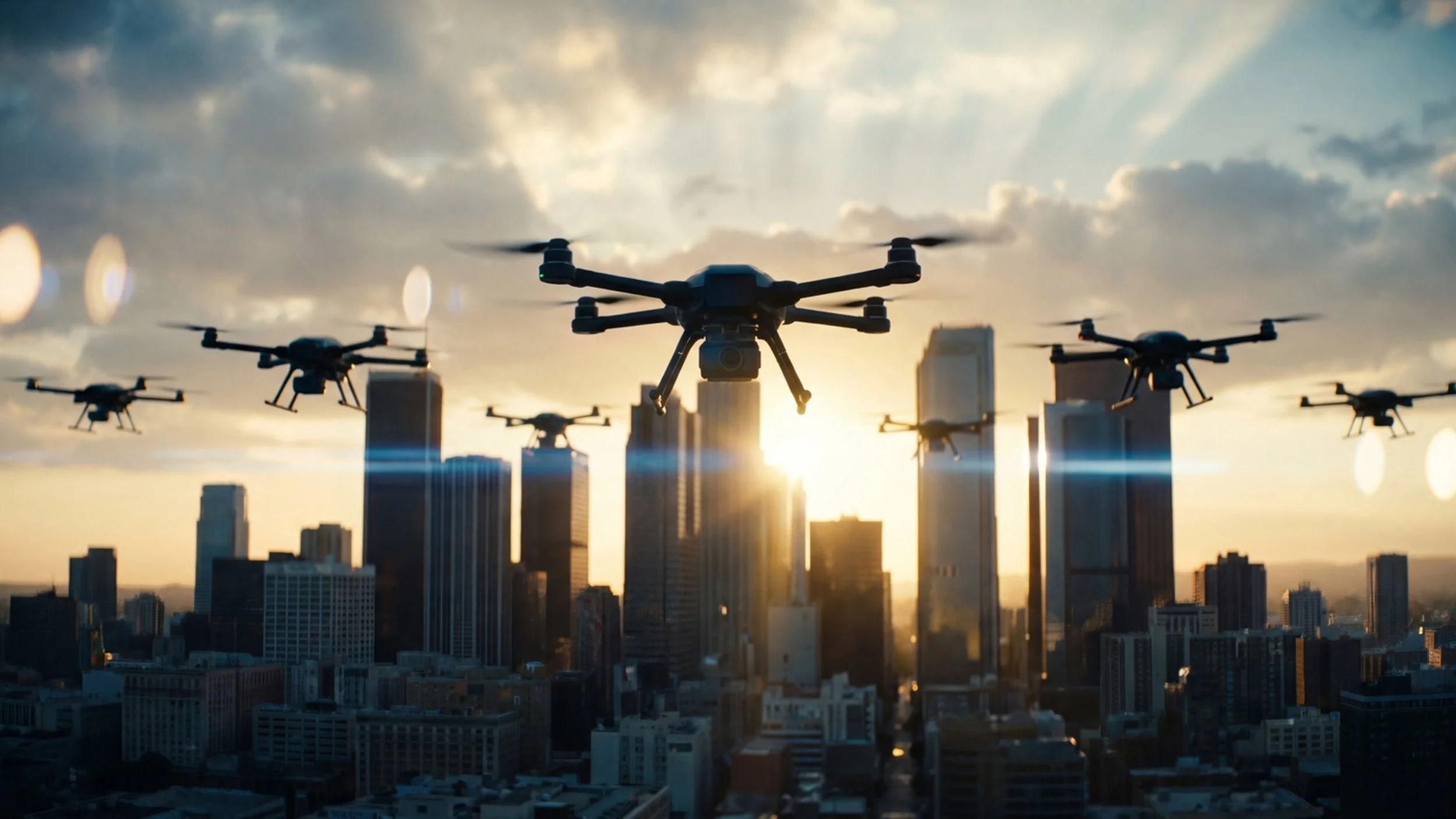
FCC Launches "Drone Dominance" Proceeding — Seeks Public Input
The Federal Communications Commission — the FCC, the agency that regulates wireless communications in the United States — just opened a formal proceeding aimed at accelerating U.S. drone industry growth. The agency is asking the public to weigh in on how to cut red tape, expand access to radio spectrum (the wireless frequencies drones need to communicate), and support domestic manufacturing.
FCC Chairman Brendan Carr visited an Anduril Industries test site in Texas to review cutting-edge drone and counter-drone technology before announcing the proceeding. His message was direct: domestic drone production, deployment, and exports are now seen as critical to national security, technological leadership, and global competitiveness.
The FCC has already accelerated approvals for experimental drone licenses — up 68% compared to the 2021-2024 period. The agency is also exploring the creation of "drone innovation zones" where companies can test new technologies with fewer restrictions.
Red Raven's Take: This is a big deal for anyone in the drone industry. The government is signaling that it wants to make it easier — not harder — for U.S. operators and manufacturers to fly, build, and innovate. If you have thoughts on what regulations are slowing you down, now is the time to speak up. Public comments are due May 1, 2026, with reply comments due May 18. This is your chance to shape the rules that will govern the industry for years to come.
Read more: FCC Drone Dominance Public Notice Seeks Input on US Industry — DRONELIFE | FCC eyes sweeping reforms to boost US drone power — DroneDJ
Drone Swarms Penetrate Nuclear Bomber Base for a Week
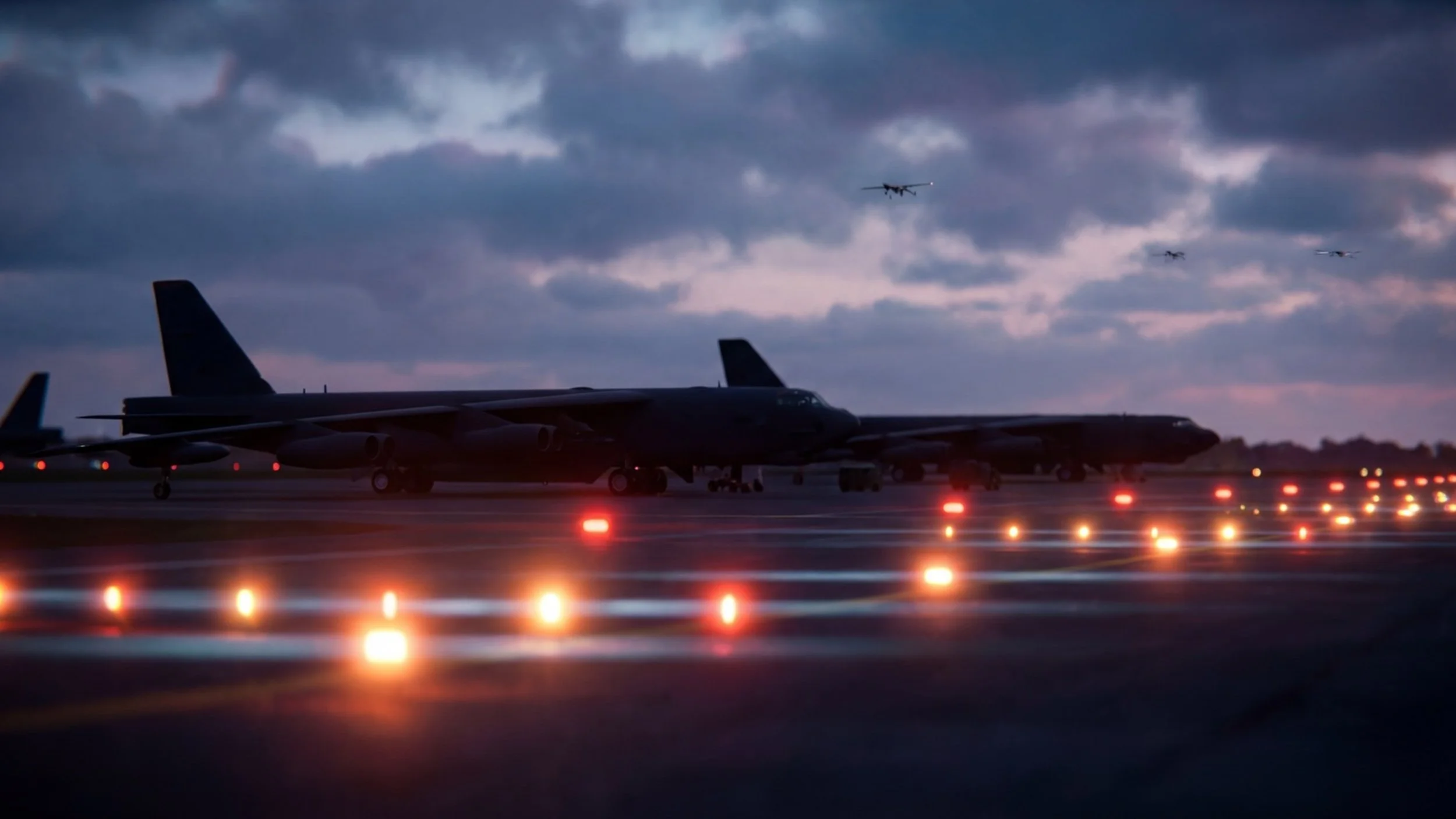
Barksdale Air Force Base in Louisiana — home to B-52 bombers and nuclear weapons storage facilities — detected multiple unauthorized drones flying over sensitive areas between March 9 and March 15. This wasn't a single incident. According to a confidential military briefing obtained by ABC News, security forces observed "multiple waves of 12-15 drones" operating over the installation, including the flight line where bombers are parked.
These weren't hobbyist drones that wandered into restricted airspace. The briefing describes aircraft with "non-commercial signal characteristics, long-range control links and resistance to jamming." The drones entered and exited the base in patterns that suggested deliberate attempts to avoid being tracked. Analysts assessed "with high confidence" that unauthorized drone flights would continue.
The base issued a shelter-in-place order on March 9 and was forced to halt flight line operations multiple times during the week-long incursion. The investigation is ongoing, and no arrests have been announced.
Red Raven's Take: This story matters for two reasons. First, it's a stark reminder that drone technology is now a legitimate security threat — not a theoretical one. Sophisticated actors can deploy coordinated drone swarms that are difficult to detect, track, or stop. Second, it's why understanding airspace restrictions is so important for every drone operator. Flying near military installations is a federal crime, and incidents like this will only increase scrutiny on all drone activity near sensitive sites. If you're flying commercially, make sure your team understands where they can and can't operate.
Read more: 'Multiple waves' of unauthorized drones spotted over strategic US Air Force base — ABC News | Drone incursion at Air Force nuclear bomber base under investigation — Washington Times
Manna Raises $50 Million to Scale Drone Delivery Across the U.S.
Irish drone delivery company Manna Air Delivery just announced a $50 million Series B funding round, bringing total investment to $110 million. The round was led by ARK Invest — the same firm that backed OpenAI, Tesla, and SpaceX — along with the Ireland Strategic Investment Fund and Schooner Capital.
Manna has completed more than 250,000 commercial drone deliveries to date, making it one of the most active drone delivery networks in the world. The company operates in Ireland, Finland, and Texas, delivering everything from food and clothing to medical supplies. Deliveries typically arrive in under three minutes.
The new funding will support expansion to up to 40 new operational bases in the United States, along with 400 new jobs in robotics, software engineering, and aviation operations. CEO Bobby Healy emphasized that the company has moved beyond testing: "We've proven the technology and the economics of autonomous delivery. Now it's about scale."
Red Raven's Take: Drone delivery is no longer a science project. Companies like Manna are proving that autonomous aerial logistics can work at scale — and investors are betting hundreds of millions of dollars on that future. For drone pilots and operators, this signals growing demand for skilled professionals who understand commercial UAS operations. If you're getting your Part 107 certification, delivery operations are increasingly a viable career path. For public safety teams, watch how these networks develop — the same infrastructure being built for consumer delivery will eventually support medical supply transport and emergency response.
Read more: Manna Raises $50M to Expand Drone Delivery Network in the U.S. — DRONELIFE | Drone company Manna to create 400 jobs — The Irish Times
Sikorsky and Robinson Unveil Autonomous Cargo Helicopter
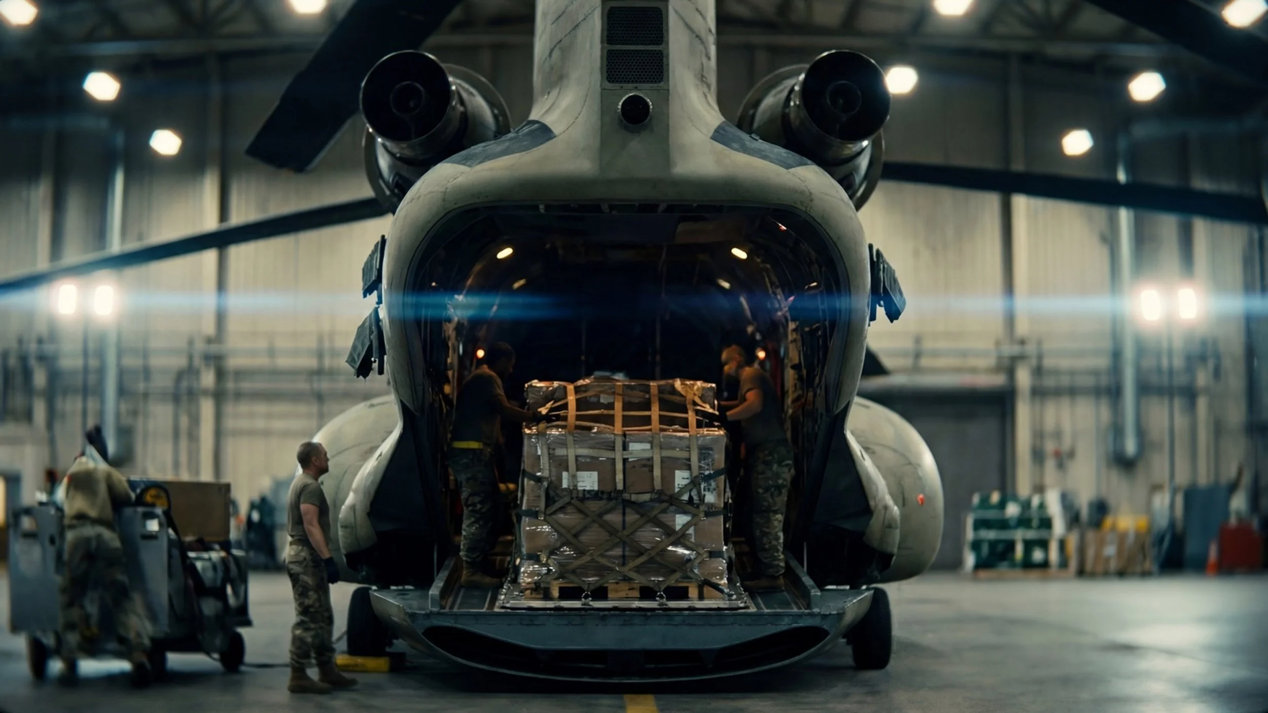
Sikorsky, a Lockheed Martin company, and Robinson Helicopter Company announced the R66 TURBINETRUCK — an autonomous cargo helicopter that combines Sikorsky's proven MATRIX autonomy system with Robinson's new cargo UAS platform.
The TURBINETRUCK is designed for missions where you need to move supplies into difficult locations without putting pilots at risk. Think disaster relief, remote-site resupply, or contested logistics in military operations. The aircraft has no cockpit — it's all cargo space, with a high-volume fuselage and nose-mounted clamshell door for rapid loading of palletized freight.
This is the 21st aircraft enabled by Sikorsky's MATRIX autonomy system, which has logged over 1,000 flight hours across platforms ranging from small drones to strategic cargo planes. Once loaded, an operator inputs mission goals via a tablet, and the MATRIX system automatically generates a flight plan and flies the helicopter to its destination using cameras, sensors, and algorithms.
Red Raven's Take: When Lockheed Martin and Robinson Helicopter — companies that have built their business on piloted aircraft — invest this heavily in autonomous systems, it tells you where aviation is heading. This isn't fringe technology anymore. If you're involved in logistics, emergency management, or cargo operations, autonomous aircraft like the TURBINETRUCK will eventually be part of your toolkit. For drone operators, the skills you're developing today — understanding autonomous systems, flight planning, mission management — are directly transferable to these larger platforms.
Read more: Sikorsky Collaborates with Robinson Helicopter Company — sUAS News
Terra Drone Invests in Ukrainian Interceptor Drone Developer
Japan's Terra Drone Corporation announced a strategic investment in Amazing Drones, a Ukrainian company that develops interceptor drones designed to shoot down enemy aircraft. The partnership also includes the launch of the Terra A1, a new interceptor drone that can reach speeds of 300 km/h and engage targets at distances up to 32 kilometers.
Amazing Drones built its expertise in the real-world combat conditions of Ukraine, where electronic warfare and signal jamming are constant challenges. The company's systems are designed to operate when GPS is unreliable and communications are under attack. Terra Drone sees this battlefield-tested expertise as invaluable.
The Terra A1 is designed as a lower-cost alternative to missile-based interception systems. At an estimated $3,000 per unit, it offers a way to counter threats like Iranian Shahed-type attack drones without spending millions on traditional air defense missiles.
Red Raven's Take: The drone industry is increasingly split between two worlds: commercial applications like delivery and inspection, and defense applications like the interceptors being developed here. What's notable is how combat experience is now being treated as a valuable export. Ukrainian drone developers have learned lessons under fire that no simulation can replicate. For those of us in the commercial space, this is a reminder that the same fundamental technologies — autonomy, sensors, communication systems — underpin both worlds. Understanding how drones work at a deep level makes you valuable across sectors.
Read more: Terra Drone Invests in Ukraine-Based Interceptor Drone Company — DRONELIFE
DJI Launches Free 3D Model Viewer — Making Drone Data Easier to Share

DJI just released DJI Reality, a free 3D model viewer that integrates with their Terra mapping software. If you've ever captured drone mapping data and then struggled to share the results with clients who don't have specialized software, this tool is designed to solve that problem.
DJI Reality supports mesh models, point clouds, and 3D Gaussian Splatting — the technical formats that drone mapping software produces. The viewer requires no login, installs almost instantly, and is lightweight enough for large teams to deploy easily. Users can explore complex datasets, switch between views, and display multiple models simultaneously.
The software also includes presentation features like guided fly-throughs of 3D environments and off-screen rendering up to 4K resolution. That means you can turn raw mapping data into polished, client-ready presentations without needing separate software.
Red Raven's Take: This matters because 3D mapping data is becoming standard across industries — construction, surveying, insurance, public safety, infrastructure inspection. The challenge has always been the "last mile": getting that complex data into the hands of decision-makers who don't have CAD software or mapping expertise. By making the viewer free and frictionless, DJI is removing one of the biggest barriers to drone data adoption. If you're doing mapping or inspection work, this makes your deliverables more accessible to clients. And for DJI, it's a smart ecosystem play — once clients are viewing data in DJI's tools, they're more likely to keep buying DJI hardware.
Read more: DJI Reality: This new free tool could change how you share drone data — DroneDJ
What This Week Means for the Industry

Step back and look at these stories together. The U.S. government is actively trying to accelerate domestic drone development. Traditional aerospace companies are pivoting hard toward autonomous systems. Drone delivery infrastructure is scaling rapidly. And the security implications of drone technology are becoming impossible to ignore.
For commercial operators, this means growing demand for your skills — but also increasing scrutiny on safety, compliance, and professionalism. For public safety agencies, the question isn't whether to adopt drone technology, but how quickly you can build a program that keeps pace with both the opportunities and the threats.
And for anyone still on the fence about whether drones are "the future" — that future arrived this week.
For breaking drone news as it happens — and our weekly debrief on what matters most — check out The Briefing Room.
Links & Resources
Part 107 Online Course: https://www.redravenuas.com/part107
Drone Program Consulting: https://www.redravenuas.com/consulting
On-Site Training: https://www.redravenuas.com/training
News & Briefing Room: https://www.redravenuas.com/news
Blog: https://www.redravenuas.com/blog
Podcast: https://www.redravenuas.com/podcast
Services: https://www.redravenuas.com/services
-
What is the FCC drone dominance proceeding?
The FCC opened a public comment period asking for input on how to reduce regulatory barriers, expand spectrum access, and support U.S. drone manufacturers. Comments are due May 1, 2026. This proceeding could shape drone regulations for years to come.What happened at Barksdale Air Force Base?
Between March 9-15, 2026, security forces detected multiple waves of 12-15 unauthorized drones flying over the nuclear bomber base. The drones showed sophisticated capabilities including jamming resistance. The investigation is ongoing.Is Manna drone delivery available in the United States?
Yes. Manna currently operates in Texas and plans to expand to up to 40 new U.S. bases with the new $50 million funding round. The company has completed over 250,000 deliveries globally.What is the Sikorsky MATRIX autonomy system?
MATRIX is Sikorsky's autonomous flight system that allows aircraft to fly without human pilots. It uses cameras, sensors, and algorithms to navigate. The system has been deployed on 21 different aircraft types, from small drones to large cargo planes.What is DJI Reality?
DJI Reality is a free 3D model viewer that lets anyone view and explore drone mapping data without specialized software. It supports mesh models, point clouds, and 3D Gaussian Splatting, and includes presentation features for client deliverables.How do I submit comments to the FCC drone proceeding?
Public comments can be submitted through the FCC's Electronic Comment Filing System (ECFS). The deadline for initial comments is May 1, 2026, with reply comments due May 18, 2026.
Is your agency ready for what's coming?
At Red Raven UAS, we help public safety agencies, utilities, and enterprise teams stay ahead of it all with vendor-neutral consulting, customized on-site training, and FAA Part 107 certification.
Program Development: We help you design and build a compliant drone program from the ground up
On-Site Training: We train your pilots for the exact missions they'll fly — not generic flight skills
Vendor-Neutral: We don't sell hardware. We help you make smart decisions based on your mission
Don't let the pace of change leave your program behind — let's build your roadmap.
About Red Raven UAS
Red Raven UAS was founded by public safety and drone industry veterans who understood the gap between having drones and knowing how to deploy them effectively. Our team brings together decades of real-world operational experience — including building one of the nation's first major public safety drone programs — and deep expertise in the commercial UAS sector across energy, utilities, and infrastructure.
We work with utility operators, energy companies, and infrastructure organizations to build drone inspection programs designed around their specific assets, workflows, and operational requirements — not a generic course deck. No hardware sales. No one-size-fits-all curriculum. Just field-tested instruction and independent program development guidance from people who have actually built and operated UAS programs at scale.
From initial program assessment and ROI modeling through pilot training, SOP development, and data workflow design, Red Raven delivers the full program infrastructure utilities need to deploy drones effectively — and keep them performing.
Explore More